- Professional Development
- Medicine & Nursing
- Arts & Crafts
- Health & Wellbeing
- Personal Development
Sustainable Transportation
By Compete High
Sustainable Transportation Sales Overview Welcome to the future of transportation! Our comprehensive product, 'Sustainable Transportation,' is designed to revolutionize the way we move people and goods while preserving our planet for generations to come. With a focus on six key modules, we offer a holistic approach to addressing the challenges of transportation sustainability. Module 1: Introduction to Sustainable Transportation In this foundational module, users will gain a comprehensive understanding of sustainable transportation principles, including the importance of reducing carbon emissions, promoting energy efficiency, and enhancing accessibility. Through engaging content and interactive learning materials, participants will grasp the significance of transitioning to sustainable transportation solutions. Module 2: Sustainable Transportation Policies and Regulations Navigate the complex landscape of transportation policies and regulations with ease. Our expertly curated module provides insights into global and local policies aimed at promoting sustainable transportation practices. From emissions standards to incentives for green mobility, participants will learn how regulatory frameworks shape the future of transportation. Module 3: Sustainable Transportation Infrastructure Discover the backbone of sustainable transportation systems: infrastructure. From bike lanes to electric vehicle charging stations, this module explores innovative infrastructure solutions designed to support eco-friendly modes of transportation. Participants will explore case studies and best practices for building resilient, accessible, and environmentally conscious transportation networks. Module 4: Sustainable Transportation Technologies Embrace the cutting-edge technologies driving the shift towards sustainable transportation. From electric vehicles to smart traffic management systems, this module showcases the latest advancements in clean and efficient transportation technologies. Participants will learn how emerging technologies are reshaping the way we commute, deliver goods, and reduce our carbon footprint. Module 5: Sustainable Transportation Behavior Change Unlock the power of behavioral psychology in promoting sustainable transportation choices. This module delves into strategies for encouraging mode shifts, such as public awareness campaigns, incentives, and community engagement initiatives. Participants will explore behavior change theories and practical interventions to promote eco-friendly transportation habits. Module 6: Sustainable Freight and Logistics Transform the way goods are transported with our module on sustainable freight and logistics. From optimizing supply chains to adopting green shipping practices, participants will learn how to minimize the environmental impact of freight transportation. Case studies and industry insights will highlight innovative approaches to sustainable logistics management. Whether you're an urban planner, policymaker, transportation professional, or sustainability enthusiast, our 'Sustainable Transportation' product offers the knowledge and tools needed to create a greener, more efficient, and equitable transportation system. Join us in shaping the future of mobility and building a sustainable world for all. Course Curriculum Module 1_ Introduction to Sustainable Transportation Introduction to Sustainable Transportation 00:00 Module 2_ Sustainable Transportation Policies and Regulations Sustainable Transportation Policies and Regulations 00:00 Module 3_ Sustainable Transportation Infrastructure Sustainable Transportation Infrastructure 00:00 Module 4_ Sustainable Transportation Technologies Sustainable Transportation Technologies 00:00 Module 5_ Sustainable Transportation Behavior Change Sustainable Transportation Behavior Change 00:00 Module 6_ Sustainable Freight and Logistics Sustainable Freight and Logistics 00:00

Catalyst for Triumph: Navigating the Pinnacle of Success
By Compete High
ð Unleash Your Potential with 'Catalyst for Triumph: Navigating the Pinnacle of Success' ð Are you ready to transform your life and become the architect of your success story? Welcome to a transformative online journey that will redefine your approach to success - 'Catalyst for Triumph: Navigating the Pinnacle of Success.' ð Module 1: Introduction & Fundamentals Embark on this exhilarating adventure with a solid foundation. Discover the core principles and mindset that set the stage for your triumph. Lay the groundwork for a journey that will elevate your life to new heights. ð¥ Module 2: Rituals of Highly Successful Individuals Unlock the secrets of the elite. Dive into the daily habits and rituals that distinguish the most successful people on the planet. Learn how to incorporate these practices into your life to create a framework for sustained success. ðª Module 3: Powerful Success Rituals Elevate your game with advanced success rituals that empower you to navigate challenges and seize opportunities. Harness the power of your mindset, productivity, and resilience to propel yourself towards your goals. ð Module 4: Morning & Evening Success Rituals Craft your day with purpose and close it with fulfillment. Explore rituals tailored for your mornings and evenings that optimize your productivity, enhance your well-being, and set the stage for triumph every day. ð Module 5: Conclusion Synthesize your learning and create a personalized roadmap for your ongoing success. This concluding module ensures that you leave with a clear vision, actionable steps, and the unwavering confidence to continue your journey toward triumph. ð What Sets This Course Apart? Practical Strategies: No fluff, just actionable strategies that deliver results. Expert Guidance: Learn from seasoned experts who have navigated their way to the pinnacle of success. Interactive Learning: Engage in thought-provoking discussions, assignments, and activities that solidify your understanding. Community Support: Connect with like-minded individuals, share experiences, and build a network that propels you forward. ð Unlock Your Potential Today! Don't let success be a distant dream. Join 'Catalyst for Triumph' and transform your life. This course is your catalyst for achieving the success you've always envisioned. Enroll Now! Your triumph awaits. Are you ready to seize it? Course Curriculum Introduction & Fundamentals Introduction 00:00 Success Rituals Fundamentals 00:00 Rituals OF Highly Successful Individuals Rituals Of Highly Successful individuals (Pt1) 00:00 Rituals Of Highly Successful Individuals (Pt2) 00:00 Powerful Success Rituals Empowering & Disempowering Rituals 00:00 Building Your Own Success Rituals 00:00 6 Core Success Rituals 00:00 Morning & Evening Success Rituals Morning Success Rituals 00:00 Evening Success Rituals 00:00 Conclusion Final Ideas & Tips 00:00

Plant-Powered Wellness: A Guide to Thriving on a Vegan Diet
By Compete High
ð± Unlock Your Vibrant Life with Plant-Powered Wellness! ð¿ Are you ready to embrace a lifestyle that not only nourishes your body but also revitalizes your spirit? Introducing 'Plant-Powered Wellness: A Guide to Thriving on a Vegan Diet' - the transformative online course that will empower you to unleash the full potential of a plant-based lifestyle! ð What's Inside: â Comprehensive Nutrition Insights: Dive deep into the world of plant-based nutrition with expert guidance. Learn how to optimize your diet to ensure you're getting all the essential nutrients for a thriving, energetic life. â Delicious & Nutrient-Rich Recipes: Elevate your culinary skills with mouthwatering recipes designed to make your taste buds dance and your body thank you. From hearty main courses to decadent desserts, discover the joy of plant-based cooking. â Mind-Body Connection: Explore the holistic benefits of a plant-powered lifestyle. Understand the connection between what you eat and how you feel, both mentally and physically. Achieve balance and harmony in every aspect of your life. â Meal Planning Mastery: Say goodbye to the stress of meal planning! Our course provides you with practical tools and strategies to effortlessly plan and prepare delicious, nourishing meals that align with your plant-powered goals. â Expert Q&A Sessions: Get your burning questions answered by seasoned plant-based nutrition experts. Join live Q&A sessions to gain insights, troubleshoot challenges, and connect with a supportive community on the same journey. â Lifetime Access: Enjoy unlimited access to the course materials, updates, and community discussions. Dive into the content at your own pace, revisit lessons whenever you need, and stay connected with like-minded individuals on the same wellness journey. ð Why Choose Plant-Powered Wellness? ð Transformative Results: Experience a profound shift in your energy levels, mental clarity, and overall well-being. ð Sustainable Lifestyle: Learn how a plant-based diet can contribute to a healthier planet and make choices that align with your values. ð Community Support: Connect with a vibrant community of learners, share experiences, and uplift each other on your plant-powered journey. ð Expert Guidance: Benefit from the knowledge of seasoned nutritionists and wellness experts who are passionate about helping you thrive. Don't miss out on this opportunity to embark on a journey to plant-powered wellness. Seize the chance to thrive on a vegan diet and cultivate a life of vitality and joy. Enroll now and embrace the transformation! ð±ð Course Curriculum Starting The Vegan Journey Introduction 00:00 The Vegan Journey - Health _ Vitality 00:00 Debunking Vegan Myths Debunking Vegan Myths 00:00 Info For Vegan Athletes Vegan Althletes - Plenty Of Muscle 00:00 Fueling The Vegan Warrior 00:00 Vegan Warrior Workout Plan 00:00 Going Vegan Going Vegan 00:00 Final Thoughts & Tips Conclusion - Final Thoughts _ Tips 00:00

Windows 10 Jumpstart: A Beginner's Guide
By Compete High
ð Windows 10 Jumpstart: A Beginner's Guide ð Are you ready to embark on a journey to master the most powerful and user-friendly operating system on the planet? Look no further! Introducing our groundbreaking online course: Windows 10 Jumpstart: A Beginner's Guide. ð Unlock the Secrets of Windows 10: Dive headfirst into the Windows 10 universe with confidence! Our comprehensive course is designed for beginners, guiding you through every aspect of this dynamic operating system. Whether you're a complete novice or looking to enhance your skills, this course is your gateway to Windows 10 mastery. ð ï¸ What You'll Learn: Getting Started: Navigate the Windows 10 interface effortlessly, from the Start Menu to the Desktop and beyond. Customization: Tailor Windows 10 to fit your needs with personalized settings, themes, and desktop configurations. Productivity Hacks: Unleash the full potential of Windows 10 with time-saving tips, keyboard shortcuts, and efficient multitasking techniques. Security Mastery: Safeguard your digital world with in-depth lessons on Windows Defender, firewalls, and essential security protocols. Troubleshooting Basics: Learn how to tackle common issues and optimize your system for peak performance. ð Why Choose Our Course? Beginner-Friendly: No tech-speak here! We break down complex concepts into easy-to-understand lessons suitable for everyone. Interactive Learning: Engage with hands-on activities, quizzes, and practical exercises to reinforce your newfound knowledge. Lifetime Access: Enjoy unlimited access to the course material, allowing you to learn at your own pace and revisit lessons whenever you need a refresher. Expert Instructors: Our seasoned instructors are passionate about empowering you with the skills you need to navigate Windows 10 like a pro. ð¡ Don't Miss Out on This Opportunity to Master Windows 10! Whether you're a student, professional, or tech enthusiast, Windows 10 Jumpstart: A Beginner's Guide is your ticket to unlocking the full potential of your computer. Enroll today and embark on a transformative learning experience! Course Curriculum Basic Overview 00:00 File Explorer File Menu 00:00 File Explorer - File Menu - Part 2 00:00 File Explorer Home Menu 00:00 File Explorer - Share Menu 00:00 File Explorer - View Menu 00:00 File Explorer View Menu 00:00 File Explorer Search Menu 00:00 Managing Your Desktop 00:00 Managing Your Display 00:00 Managing Cortana - Voice Assist 00:00 Quick Assist Settings 00:00 Media Streaming Settings 00:00 Recording A Screen Video 00:00 Recording An Audio 00:00 Taking A Snapshot of Your Screen 00:00 Recording Your Steps 00:00 Capturing Webcam Video 00:00 Adding Applications 00:00 Conclusion 00:00 Advanced Overview 00:00 Managing Start Up Speed 00:00 Managing Open Applications 00:00 Managing Your Hard Drive Space 00:00 Manaing Your Hard Drive Space - Storage Sense 00:00 Managing Frozen Applications 00:00 Managing Your PC Remotely 00:00 Manaing Your PC Remotely - Part 2 00:00 Managing Desktop Notifications - Focus Assist 00:00 Linking Your Mobile Device 00:00 Managing Your Backups and Restore Points 00:00 Managing Your Default Applications 00:00 Managing Your Workspace 00:00 Microsoft Edge - Write Notes 00:00 Managing Edge - Dot Menu 00:00 Managing Edge - Settings Menu Link 00:00 Managing Edge With Cortana 00:00 Managing Default Applications with Edge 00:00 Managing Lost Windows 00:00 Conclusion - Managing Voice Recognition 00:00

Geology
By Compete High
Uncover Earth's Secrets with Our Geology Course ð Are you ready to embark on an exciting journey deep into the heart of our planet? Look no further than our comprehensive Geology course! ðï¸ Delve into the mysteries of Earth's formation, its dynamic processes, and the incredible forces that shape our world every day. Why Choose Our Geology Course? ð Explore the Wonders of the Earth: Geology isn't just about rocks and minerals-it's a captivating study of the Earth's history, its landscapes, and the fascinating stories written in its layers. ð Discover Hidden Treasures: Uncover the secrets hidden beneath the surface as you learn about the forces of erosion, tectonic plate movements, volcanic activity, and so much more. ð Expert Guidance: Our course is crafted by seasoned geologists and educators who are passionate about sharing their knowledge and expertise with you. Get ready for an immersive learning experience! ð Hands-on Learning: From field trips to virtual simulations, our course offers hands-on experiences that bring geology to life. Whether you're studying the formation of mountains or examining fossils, you'll have the opportunity to get up close and personal with Earth's wonders. ð¡ Practical Applications: Geology isn't just an academic pursuit-it's a field with real-world applications. Gain insights into how geological knowledge is used in industries such as mining, environmental conservation, and natural resource management. Who is this for? Our Geology course is perfect for: Students: Whether you're studying earth sciences, geography, or simply have a passion for understanding the world around you, our course will deepen your understanding of the Earth's processes. Professionals: Are you working in fields such as environmental science, civil engineering, or resource exploration? Our Geology course provides valuable insights that can enhance your expertise and career prospects. Curious Minds: If you've ever looked at a mountain or a rock formation and wondered about its story, this course is for you! Geology is a fascinating subject that appeals to anyone with a sense of curiosity about the natural world. Career Path A Geology course opens doors to a wide range of exciting career opportunities, including: ðï¸ Environmental Consultant: Help businesses and organizations navigate environmental regulations and assess the impact of human activities on natural landscapes. ï¸ Geologist: Work in fields such as mineral exploration, oil and gas extraction, or geological surveys, contributing to our understanding of Earth's resources and structures. ð¿ Environmental Scientist: Study the interactions between human activities and the natural environment, working to protect ecosystems and promote sustainability. ð Park Ranger: Combine your love of the outdoors with your knowledge of geology by working in national parks or protected areas, educating visitors and preserving natural landscapes. ð Data Analyst: Analyze geological data to identify patterns, trends, and potential risks, contributing to informed decision-making in various industries. FAQ Q: Is this course suitable for beginners? A: Absolutely! Our Geology course is designed to accommodate learners of all levels, from beginners to advanced students. Our instructors provide clear explanations and support to help you grasp the fundamentals of geology. Q: What materials do I need for this course? A: All you need is a curious mind and a passion for exploring the natural world! While specific materials may vary depending on the course format, we'll provide you with everything you need to succeed, whether it's textbooks, online resources, or field trip equipment. Q: Can I take this course online? A: Yes! Our Geology course offers both in-person and online learning options to accommodate your schedule and preferences. Experience the thrill of discovery from the comfort of your own home or join us in the field for hands-on exploration-it's up to you! Q: Will this course help me find a job in the field of geology? A: While completion of our Geology course is not a guarantee of employment, it provides valuable knowledge and skills that can enhance your career prospects in geology-related fields. Networking opportunities, practical experience, and a solid understanding of geological principles can help you stand out to potential employers. Enroll Today and Uncover the Secrets of the Earth! Don't miss out on the opportunity to explore the wonders of geology and gain a deeper appreciation for the world beneath your feet. Enroll in our Geology course today and embark on a journey of discovery that will expand your horizons and ignite your passion for the natural world! ð Course Curriculum Module 1 Introduction to Geology. Introduction to Geology. 00:00 Module 2 Earths Structure and Plate Tectonics. Earth_s Structure and Plate Tectonics. 00:00 Module 3 Surface Processes and Landscape Evolution. Surface Processes and Landscape Evolution. 00:00 Module 4 Earths Interior and Geophysical Processes. Earth_s Interior and Geophysical Processes. 00:00 Module 5 Earth Materials and Minerals. Earth Materials and Minerals. 00:00 Module 6 Geological Time and Earth_s History. Geological Time and Earth_s History. 00:00

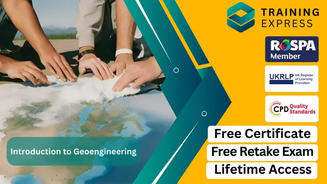
Geoengineering is a rapidly emerging field that focuses on manipulating the Earth’s environment to combat climate change. This course offers a deep dive into the science and techniques used in geoengineering, with a clear focus on methods designed to reduce global warming and other environmental issues. Students will explore various geoengineering concepts, from carbon capture and storage to solar radiation management, while evaluating their potential impact on the planet. The course is designed to equip learners with an understanding of the technological, ethical, and societal implications of these approaches. By the end of the course, learners will have a solid foundation in the core principles of geoengineering, enabling them to critically assess the possible solutions it offers for mitigating climate change. The course delves into both the technical and policy aspects, giving learners a well-rounded perspective on this cutting-edge field. It will also explore current research and debates surrounding geoengineering, providing an engaging experience that blends science with social responsibility. Whether you're looking to pursue a career in environmental sciences or simply have an interest in climate change solutions, this course offers a clear and accessible introduction to the field of geoengineering. Key Features CPD Accredited FREE PDF + Hardcopy certificate Fully online, interactive course Self-paced learning and laptop, tablet and smartphone-friendly 24/7 Learning Assistance Discounts on bulk purchases Course Curriculum Module 01: Earth Processes and Soil Basics Module 02: Soil Classification and Behaviour Module 03: Geotechnical Properties of Soils Module 04: Ground Improvement Techniques Module 05: Geoenvironmental Engineering Module 06: Geotechnical Site Investigation Learning Outcomes: Analyse Earth processes influencing soil behaviour for effective engineering solutions. Demonstrate proficiency in classifying soils to inform geotechnical decisions. Evaluate geotechnical properties of soils crucial for engineering applications. Apply ground improvement techniques for enhanced stability and performance. Assess the intersection of geotechnology and environmental considerations. Conduct geotechnical site investigations with precision and interpretive skills. Accreditation This course is CPD Quality Standards (CPD QS) accredited, providing you with up-to-date skills and knowledge and helping you to become more competent and effective in your chosen field. Certificate After completing this course, you will get a FREE Digital Certificate from Training Express. CPD 10 CPD hours / points Accredited by CPD Quality Standards Who is this course for? Civil engineers aspiring to specialise in geoengineering. Environmental scientists seeking a geotechnical perspective. Construction professionals enhancing their soil engineering expertise. Graduates pursuing a career in geotechnical engineering. Project managers involved in infrastructure development. Urban planners interested in sustainable geotechnical solutions. Soil scientists aiming to apply their knowledge in practical settings. Engineering enthusiasts fascinated by the complexities of soil dynamics. Career path Geotechnical Engineer Environmental Consultant Construction Project Manager Civil Engineering Consultant Urban Planning Officer Soil Scientist Certificates Digital certificate Digital certificate - Included Once you've successfully completed your course, you will immediately be sent a FREE digital certificate. Hard copy certificate Hard copy certificate - Included Also, you can have your FREE printed certificate delivered by post (shipping cost £3.99 in the UK). For all international addresses outside of the United Kingdom, the delivery fee for a hardcopy certificate will be only £10. Our certifications have no expiry dates, although we do recommend that you renew them every 12 months.
Welcome to the Vegan Cooking Basics Course, where we bring the delicious world of plant-based cuisine right to your kitchen. Whether you’re a beginner eager to explore new flavours or someone wanting to add more variety to your meals, this course is the perfect starting point. We guide you through essential ingredients, cooking methods, and simple techniques that make vegan cooking a breeze. With easy-to-follow instructions, you’ll be cooking vibrant dishes that are not only good for you but also full of flavour. This course focuses on key concepts like understanding plant-based proteins, mastering easy-to-make vegan dishes, and learning how to balance meals for optimal nutrition. You’ll discover the joy of cooking with fresh, seasonal ingredients while embracing a diet that’s as kind to the planet as it is to your taste buds. As you explore simple yet satisfying recipes, you’ll gain confidence in the kitchen and begin to see the endless possibilities vegan cooking has to offer. So, why not take the leap into plant-based cooking and elevate your meals today? Key Features CPD Accredited FREE PDF + Hardcopy certificate Fully online, interactive course Self-paced learning and laptop, tablet and smartphone-friendly 24/7 Learning Assistance Discounts on bulk purchases Course Curriculum Module 1: Introduction to Veganism and Nutrition Module 2: Essential Nutrients in a Vegan Diet Module 3: Plant-Based Meal Planning and Preparation Module 4: Cooking Techniques and Recipe Adaptations Module 5: Vegan Nutrition for Different Life Stages Module 6: Veganism and Sustainability Module 7: Vegan Cuisine from Around the World Module 8: Vegan Nutrition and Health Learning Outcomes: Nutritional Mastery: Acquire expertise in essential nutrients for a balanced vegan diet. Culinary Adaptability: Master diverse cooking techniques and adept recipe modifications. Global Palate: Explore and recreate diverse vegan cuisines from around the world. Life Stage Nutrition: Tailor plant-based meals to meet nutritional needs at different life stages. Sustainable Cooking: Grasp the environmental impact of veganism, integrating sustainability into your culinary practice. Health-conscious Cuisine: Understand the correlation between vegan nutrition and overall health. Accreditation This course is CPD Quality Standards (CPD QS) accredited, providing you with up-to-date skills and knowledge and helping you to become more competent and effective in your chosen field. Certificate After completing this course, you will get a FREE Digital Certificate from Training Express. CPD 10 CPD hours / points Accredited by CPD Quality Standards Who is this course for? Individuals transitioning to a vegan lifestyle. Cooking enthusiasts seeking plant-based culinary expertise. Health-conscious individuals exploring diverse dietary options. Environmental advocates interested in sustainable living. Beginners eager to master vegan meal planning and preparation. Those keen on global culinary exploration through vegan dishes. Parents looking to provide balanced vegan nutrition for their families. Culinary professionals expanding their repertoire with vegan expertise. Career path Vegan Nutrition Consultant Plant-Based Chef Sustainable Food Advocate Vegan Cooking Instructor Plant-Based Diet Blogger Culinary Health Coach Certificates Digital certificate Digital certificate - Included Once you've successfully completed your course, you will immediately be sent a FREE digital certificate. Hard copy certificate Hard copy certificate - Included Also, you can have your FREE printed certificate delivered by post (shipping cost £3.99 in the UK). For all international addresses outside of the United Kingdom, the delivery fee for a hardcopy certificate will be only £10. Our certifications have no expiry dates, although we do recommend that you renew them every 12 months.
Are you curious about sustainable farming practices that honour nature’s rhythm and balance? The Biodynamic Farming and Gardening Basics Course introduces you to a holistic approach to cultivating crops and tending to gardens. By combining organic farming techniques with spiritual and ecological principles, biodynamics provides an alternative method that enriches the soil and nurtures a thriving ecosystem. Whether you're a beginner or someone with a green thumb, this course will guide you through the foundational concepts of biodynamic farming, equipping you with the knowledge to integrate these practices into your gardening or farming projects. Learn how to work in harmony with the natural cycles of the moon and the planets to optimise plant growth, improve soil health, and boost your garden's resilience. Through insightful lessons, you’ll discover the value of composting, crop rotation, and herbal preparations that support healthy ecosystems. With clear explanations and practical insights, this course invites you to explore biodynamics in a way that’s accessible and enjoyable. It’s an engaging journey into a more sustainable and thoughtful way of gardening that respects the earth while yielding rewarding results. Key Features CPD Accredited FREE PDF + Hardcopy certificate Fully online, interactive course Self-paced learning and laptop, tablet and smartphone-friendly 24/7 Learning Assistance Discounts on bulk purchases Course Curriculum Module 01: Introduction to Biodynamic Farming Module 02: Soil Health and Preparation Module 03: Biodynamic Preparations and Formulations Module 04: The Lunar Calendar & Planting Module 05: Biodynamic Gardening Techniques Module 06: Biodynamic Animal Husbandry Module 07: The Social and Economic Dimensions Module 08: Biodynamic Farming Case Studies and Success Stories Learning Outcomes: Analyse and apply biodynamic principles in farming and gardening. Enhance soil health through proven preparation techniques. Formulate and implement biodynamic remedies for plant vitality. Optimise planting schedules based on lunar cycles for maximum yield. Implement advanced gardening techniques rooted in biodynamic principles. Integrate holistic animal husbandry practices into farming operations. Accreditation This course is CPD Quality Standards (CPD QS) accredited, providing you with up-to-date skills and knowledge and helping you to become more competent and effective in your chosen field. Certificate After completing this course, you will get a FREE Digital Certificate from Training Express. CPD 10 CPD hours / points Accredited by CPD Quality Standards Who is this course for? Aspiring farmers seeking sustainable agricultural practices. Gardeners eager to enhance crop yields through holistic methods. Environmental enthusiasts passionate about eco-friendly farming. Individuals interested in the spiritual and cosmic dimensions of agriculture. Those curious about integrating animal husbandry with farming practices. Sustainable living advocates aiming for self-sufficiency in food production. Existing farmers keen to diversify and explore biodynamic methods. Anyone intrigued by the social and economic aspects of sustainable farming. Career path Biodynamic Farmer Sustainable Agriculture Consultant Organic Gardening Specialist Agricultural Educator Eco-friendly Farm Manager Livestock Integration Specialist Certificates Digital certificate Digital certificate - Included Once you've successfully completed your course, you will immediately be sent a FREE digital certificate. Hard copy certificate Hard copy certificate - Included Also, you can have your FREE printed certificate delivered by post (shipping cost £3.99 in the UK). For all international addresses outside of the United Kingdom, the delivery fee for a hardcopy certificate will be only £10. Our certifications have no expiry dates, although we do recommend that you renew them every 12 months.
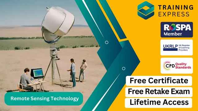
Remote sensing technology has transformed the way we perceive and analyse the Earth’s surface. With a broad range of applications from agriculture and environmental management to urban planning and climate research, this course introduces learners to the core concepts and techniques that underpin this fascinating field. Over the duration of this course, you’ll gain a solid foundation in remote sensing principles, satellite data interpretation, and various imaging systems that provide invaluable insights into our planet. The course is designed to equip you with the knowledge necessary to understand the growing significance of remote sensing in solving complex global challenges. Whether you're a student of environmental science, geography, or simply curious about the potential of remote sensing technology, this course will enhance your understanding of how we collect and process data remotely. By exploring the key technologies used in satellite imagery, radar systems, and the application of data for decision-making, you'll be poised to explore the wide range of industries that benefit from this technology. This course is an ideal starting point for those wishing to pursue further study or a career in geospatial technologies. Step into the world of remote sensing and uncover how these advanced systems can make a real impact on our world. Key Features CPD Accredited FREE PDF + Hardcopy certificate Fully online, interactive course Self-paced learning and laptop, tablet and smartphone-friendly 24/7 Learning Assistance Discounts on bulk purchases Course Curriculum Module 01: Introduction to Remote Sensing Module 02: Electromagnetic Spectrum and Remote Sensing Module 03: Platforms and Sensors Module 04: Image Interpretation Module 05: Remote Sensing Data Analysis Module 06: Applications of Remote Sensing in the UK Module 07: Future Trends in Remote Sensing Learning Outcomes: Master electromagnetic spectrum concepts crucial for remote sensing proficiency. Acquire knowledge of diverse platforms and sensors employed in the field. Develop expertise in interpreting intricate visual data from remote sensing. Hone skills in remote sensing data analysis tailored to the UK landscape. Explore applications spanning environmental monitoring to urban planning. Stay ahead by understanding the future trends shaping remote sensing technology. Accreditation This course is CPD Quality Standards (CPD QS) accredited, providing you with up-to-date skills and knowledge and helping you to become more competent and effective in your chosen field. Certificate After completing this course, you will get a FREE Digital Certificate from Training Express. CPD 10 CPD hours / points Accredited by CPD Quality Standards Who is this course for? Enthusiasts eager to explore remote sensing technology. Students aspiring to deepen their knowledge in earth observation. Professionals seeking to enhance their skill set in geospatial analysis. Government employees involved in environmental monitoring. Researchers interested in leveraging remote sensing for diverse studies. Urban planners aiming to integrate technology into city development. Geographers keen on applying remote sensing in their research. Anyone intrigued by the future possibilities of remote sensing technology. Career path Environmental Analyst GIS Specialist Satellite Data Analyst Urban Planner Remote Sensing Researcher Geospatial Consultant Certificates Digital certificate Digital certificate - Included Once you've successfully completed your course, you will immediately be sent a FREE digital certificate. Hard copy certificate Hard copy certificate - Included Also, you can have your FREE printed certificate delivered by post (shipping cost £3.99 in the UK). For all international addresses outside of the United Kingdom, the delivery fee for a hardcopy certificate will be only £10. Our certifications have no expiry dates, although we do recommend that you renew them every 12 months.
Airports don’t just move planes—they move people, stories, and entire economies. Our Airport Management: Passenger Terminal Management Course dives into the nuts and bolts of how terminals operate, from check-in desks to baggage belts, and everything in between. You’ll learn how to keep passenger flow smooth, minimise delays, and ensure terminals stay safe, clean, and efficient—without needing to leave your seat. With global air travel forecast to double by 2040, demand for knowledgeable airport personnel is rising fast. This course gives you a clear picture of terminal layouts, service zones, passenger handling, and crisis control—all delivered in a way that’s simple, structured, and smart. Whether you're aiming for a role in airport operations or just want to know how airports tick, this course has you covered—minus the turbulence. Key Features of the Airport Management Course : Instant e-certificate and hard copy dispatch by next working day Fully online, interactive Airport Management course with audio voiceover Developed by professionals in the field Self-paced learning and laptop, tablet, smartphone-friendly 24/7 Learning Assistance Discounts on bulk purchases *** Additional Gifts *** Free Life coaching Course *** (Offer Ends Soon) *** Course Curriculum The detailed curriculum outline of our Airport Management course is as follows: Module 01: Introduction to Airport Management Module 02: Airport Customer Service Module 03: Passenger Terminal Management Module 04: Airport Components Module 05: Airport Peaks and Airline Scheduling Module 06: Cargo Management Module 07: Aviation Noise Control Module 08: Weather Control Module 09: Sustainable Airport Management Module 10: Security Management Module 11: Innovation and Growth Accreditation All of our courses are fully accredited, including this Airport Management: Passenger Terminal Management Course, providing you with up-to-date skills and knowledge and helping you to become more competent and effective in Airport Management. Certification Once you've successfully completed your Airport Management: Passenger Terminal Management Course, you will immediately be sent a digital certificate. Also, you can have your printed certificate delivered by post (shipping cost £3.99). Our Airport Management: Passenger Terminal Management Course certification has no expiry dates, although we do recommend that you renew them every 12 months. CPD 10 CPD hours / points Accredited by The CPD Quality Standards Who is this course for? This Airport Management: Passenger Terminal Management Course can be taken by anyone who wants to understand more about the topic. With the aid of this course, you will be able to grasp the fundamental knowledge and ideas. Additionally, this Airport Management: Passenger Terminal Management Course is ideal for: Individuals aspiring to work in airport management roles. Graduates seeking to enter the aviation industry. Airport staff aiming to advance their careers. Professionals looking to transition into airport management. Anyone interested in the dynamic field of airport operations. Requirements Learners do not require any prior qualifications to enrol on this Airport Management: Passenger Terminal Management Course. You just need to have an interest in Airport Management: Passenger Terminal Management Course. Career path After completing this Airport Management Course you will have a variety of careers to choose from. The following job sectors of This Airport Management Course are: Airport Operations Manager - £35K to £60K/year. Airport Customer Service Supervisor - £25K to £40K/year. Airport Security Officer - £20K to £30K/year. Airline Scheduler - £30K to £50K/year. Cargo Operations Manager - £30K to £50K/year. Certificates Digital certificate Digital certificate - Included Once you've successfully completed your course, you will immediately be sent a FREE digital certificate. Hard copy certificate Hard copy certificate - Included Also, you can have your FREE printed certificate delivered by post (shipping cost £3.99 in the UK). For all international addresses outside of the United Kingdom, the delivery fee for a hardcopy certificate will be only £10. Our certifications have no expiry dates, although we do recommend that you renew them every 12 months.
