- Professional Development
- Medicine & Nursing
- Arts & Crafts
- Health & Wellbeing
- Personal Development
78 Courses
ArcGIS Desktop for Spatial Analysis: Go from Basic to Pro
By Packt
Gain proficiency in the mastery of Geographic Information Systems (GIS) via ArcGIS Desktop
24-Hour Knowledge Knockdown! Prices Reduced Like Never Before Imagine you are soaring high above the earth, observing the world from a bird's-eye view. Remote Sensing in ArcGIS bundle could be your ticket to experiencing the world in a way you never have before. In the UK alone, the geospatial industry contributes over £11 billion to the economy. With 11 courses, this Remote Sensing in ArcGIS bundle is a one-stop shop for all your GIS and remote sensing needs. The bundle's crown jewel is the Remote Sensing in ArcGIS course, which is QLS-endorsed and comes with a hardcopy certificate. With courses covering everything from QGIS Cartography to Business Intelligence and Data Mining Diploma, this bundle is a comprehensive guide to all things remote sensing. You'll learn how to create smart maps in Python, perform spatial analysis in ArcGIS, and even use web scraping to map dam levels. The possibilities are endless! This Remote Sensing in ArcGIS Bundle Package includes: Course 01: Award in Remote Sensing in ArcGIS at QLS Level 2 10 Premium Additional CPD QS Accredited Courses - Course 01: QGIS Cartography Course 02: Spatial Data Visualization and Machine Learning in Python Level 4 Course 03: Create Smart Maps in Python and Leaflet Level 3 Course 04: Spatial Analysis in ArcGIS Course 05: ArcGIS for Hydrology Course 06: Web Scraping and Mapping Dam Levels in Python and Leaflet Level 4 Course 07: Learn to Use Python for Spatial Analysis in ArcGIS Course 08: The Basics of ArcGIS for Hydrology Course 09: Python Data Science Course 10: Business Intelligence and Data Mining Diploma Don't miss this opportunity to expand your knowledge and skills in remote sensing. Enrol in the Remote Sensing in ArcGIS bundle today and take your first step towards exploring the world from a whole new perspective. Why Choose Us? Get a free QLS endorsed Certificate upon completion of Remote Sensing in ArcGIS Get a free student ID card with Remote Sensing in ArcGIS Training The Remote Sensing in ArcGIS is affordable and simple to understand This course is entirely online, interactive lesson with voiceover audio Lifetime access to the Remote Sensing in ArcGIS course materials The Remote Sensing in ArcGIS comes with 24/7 tutor support After taking this Remote Sensing in ArcGIS bundle courses, you will be able to learn: Gain expertise in remote sensing and GIS technologies. Understand the fundamentals of spatial data analysis and visualisation. Learn to create maps using Python and Leaflet. Explore machine learning techniques for spatial data analysis. Get hands-on experience in ArcGIS for hydrology. Understand web scraping and mapping using Python and Leaflet. Develop proficiency in data mining, business intelligence, and Python data science. ***Curriculum breakdown *** Module 01: Remote sensing, satellite images, spectral bands introduction Module 02: Layers stacking satellite images Module 03: Georeferencing satellite images Module 04: Introduction to geoprocessing raster tools Module 05: Raster Analysis Functions Module 06: Georeferencing toposheet Module 07: Site suitability using weighted overlay analysis - part 1 Module 08: Site suitability using weighted overlay analysis - part 2 Module 09: Watershed Delineation from DEM Module 10: Unsupervised classification Assessment Process You have to complete the assignment questions given at the end of the course and score a minimum of 60% to pass each exam. You will be entitled to claim a certificate endorsed by the Quality Licence Scheme after you successfully pass the Award in Remote Sensing in ArcGIS at QLS Level 2 exams. CPD 180 CPD hours / points Accredited by CPD Quality Standards Who is this course for? This bundle is ideal for: Students seeking mastery in this field Professionals seeking to enhance their skills Anyone who is passionate about this topic Requirements This Remote Sensing in ArcGIS doesn't require prior experience and is suitable for diverse learners. Career path This Remote Sensing in ArcGIS bundle will be beneficial for anyone looking to pursue a career as: GIS Analyst Remote Sensing Specialist Spatial Data Scientist Geospatial Project Manager GIS Consultant GIS Team Leader Certificates Award in Remote Sensing in ArcGIS at QLS Level 2 Hard copy certificate - Included CPD QS Accredited Certificate Hard copy certificate - Included International students are subject to a £10 delivery fee for their orders, based on their location. CPD QS Accredited PDF Certificate Digital certificate - Included
24-Hour Knowledge Knockdown! Prices Reduced Like Never Before Water is a precious resource, and its management is crucial in the UK. A recent study by the Environment Agency found that over half of England's rivers fail to meet good ecological status. Do you want to play a role in improving water management and protecting our environment? If so, then this ArcGIS for Hydrology bundle is for you! Our course delves into ArcGIS, the industry-standard GIS platform, teaching you to leverage spatial data for hydrological analysis. You'll master essential tools for tasks like watershed delineation, flow direction mapping, and floodplain modelling. Additionally, you'll gain valuable skills in spatial analysis, remote sensing for water resource monitoring, and professional cartographic techniques to effectively communicate your findings. This Diploma in ArcGIS for Hydrology at QLS Level 4 course is endorsed by The Quality Licence Scheme and accredited by CPDQS (with 120 CPD points). Our Bundle contains 5 of our premium courses for one discounted price: Course 01: Diploma in ArcGIS for Hydrology Course 02: Spatial Analysis in ArcGIS Course 03: Remote Sensing in ArcGIS Course 04: QGIS Cartography Course 05: Environmental Management Empower yourself with the knowledge and skills to become a water management expert. Enrol today and unlock a rewarding career path! Learning Outcomes of ArcGIS for Hydrology Apply core ArcGIS functions for spatial data management and analysis. Utilise hydrological tools for watershed delineation, flow modeling, and flood risk assessment. Leverage remote sensing data for water resource monitoring and change detection. Create professional and informative maps to communicate hydrological data. Automate workflows using ArcGIS scripting and geoprocessing tools. Integrate ArcGIS with other software for comprehensive water management solutions. Why Choose Us? Get a Free CPD Accredited Certificate upon completion of ArcGIS for Hydrology Get a free student ID card with ArcGIS for Hydrology Training program (£10 postal charge will be applicable for international delivery) The ArcGIS for Hydrology is affordable and simple to understand This course is entirely online, interactive lesson with voiceover audio Get Lifetime access to the ArcGIS for Hydrology course materials The ArcGIS for Hydrology comes with 24/7 tutor support Start your learning journey straightaway! *** Course Curriculum *** Course 01: Diploma in ArcGIS for Hydrology Section 01: Introduction To ArcGIS Software Introduction to ArcGIS software Selection by Location, attributes, clip features and tables to Excel Performing actions on the data: change the projections, dissolve, clip From .TXT and .DXF to shapefile Calculations with attribute table and KML files in ArcMap Export from ArcMap to PDF ArcScene 3D GIS Example Test AutoCAD fixing polygon coordinates Section 02: ArcGIS For Hydrology Download hydrological data Calculate flow direction and flow accumulation Watershed delineation Clip layers to watershed boundary Stream segments and catchments areas Stream order convert to vector Spatial join to catchments Join stream id to stream order Map data and initial layout Add and format map elements Course 02: Award in Spatial Analysis in ArcGIS Module 01: Point Density Analysis Module 02: Raster Calculator and Vector Isolation Module 03: Raster to Topography Module 04: Raster Reclassification Module 05: Raster Overlay Module 06: Slope Analysis and Hydrology tools Module 07: Introduction to TIFF Files Module 08: Introduction to 3D Surfaces Module 09: Satellite Images and TIN Surfaces Module 10: Exercise Course 03: Remote Sensing in ArcGIS Module 01: Remote sensing, satellite images, spectral bands introduction Module 02: Layers stacking satellite images Module 03: Georeferencing satellite images Module 04: Introduction to geoprocessing raster tools Module 05: Raster Analysis Functions Module 06: Georeferencing toposheet Module 07: Site suitability using weighted overlay analysis - part 1 Module 08 Site suitability using weighted overlay analysis - part 2 Module 09: Watershed Delineation from DEM Module 10: Unsupervised classification =========>>>>> And 2 More Courses <<<<<========= How will I get my Certificate? After successfully completing the course, you will be able to order your Certificates as proof of your achievement. PDF Certificate: Free (Previously it was £12.99*5 = £65) CPD Hard Copy Certificate: £29.99 CPD 50 CPD hours / points Accredited by CPD Quality Standards Who is this course for? Anyone interested in learning more about the topic is advised to take this bundle. This bundle is ideal for: Hydrologists Environmental Scientists Flood Risk Assessors GIS Analysts Water Resource Managers Requirements You will not need any prior background or expertise to enrol in this bundle. Career path After completing this bundle, you are to start your career or begin the next phase of your career. Water Management Environmental Consulting Flood Risk Management GIS Specialist Cartographer Researcher Certificates CPD Accredited Digital Certificate Digital certificate - Included Upon passing the Course, you need to order a Digital Certificate for each of the courses inside this bundle as proof of your new skills that are accredited by CPD QS for Free. CPD Accredited Hard Copy Certificate Hard copy certificate - Included Please note that International students have to pay an additional £10 as a shipment fee. Diploma in ArcGIS for Hydrology at QLS Level 4 Hard copy certificate - £99 Please note that International students have to pay an additional £10 as a shipment fee.
48-Hour Knowledge Knockdown! Prices Reduced Like Never Before! This Diploma in ArcGIS for Hydrology at QLS Level 4 course is endorsed by The Quality Licence Scheme and accredited by CPDQS (with 120 CPD points) to make your skill development & career progression more accessible than ever! If you aim to enhance your ArcGIS skills, our comprehensive ArcGIS course is perfect for you. Designed for success, this ArcGIS course covers everything from basics to advanced topics in ArcGIS. Each lesson in this ArcGIS course is crafted for easy understanding, enabling you to become proficient in ArcGIS. Whether you are a beginner or looking to sharpen your existing skills, this ArcGIS is the ideal choice. Due to ArcGIS for Hydrology at QLS Level 4's massive demand in the competitive market, you can use our comprehensive course as a weapon to strengthen your knowledge and boost your career development. Learn ArcGIS for Hydrology at QLS Level 4 from industry professionals and quickly equip yourself with the specific knowledge and skills you need to excel in your chosen career. This ArcGIS for Hydrology at QLS Level 4 training can help you to accomplish your ambitions and prepare you for a meaningful career. So, join us today and gear up for excellence! Why Prefer This ArcGIS for Hydrology at QLS Level 4 Course? Get a Free QLS-endorsed Certificate upon completion of ArcGIS Get a free student ID card with ArcGIS Training Get instant access to this ArcGIS course. Learn ArcGIS from anywhere in the world The ArcGIS is affordable and simple to understand The ArcGIS is an entirely online, interactive lesson with voiceover audio Lifetime access to the ArcGIS course materials The ArcGIS comes with 24/7 tutor support Take a step toward a brighter future! *** Course Curriculum *** Here is the curriculum breakdown of the ArcGIS for Hydrology at QLS Level 4 course: Introduction to GIS Introduction to ArcGIS software Selection by Location, attributes, clip features and tables to Excel Performing actions on the data: change the projections, dissolve, clip From .TXT and .DXF to shapefile Calculations with attribute table and KML files in ArcMap Export from ArcMap to PDF ArcScene 3D GIS Example Test and much more... Assessment Process You have to complete the assignment questions given at the end of the course and score a minimum of 60% to pass each exam. Our expert trainers will assess your assignment and give you feedback after you submit the assignment. You will be entitled to claim a certificate endorsed by the Quality Licence Scheme after you have completed all of the Diploma in ArcGIS for Hydrology at QLS Level 4 exams. CPD 120 CPD hours / points Accredited by CPD Quality Standards Who is this course for? ArcGIS for Hydrology at QLS Level 4 Requirements ArcGIS for Hydrology at QLS Level 4 Career path ArcGIS for Hydrology at QLS Level 4 Certificates CPDQS Accredited Certificate Digital certificate - Included Diploma in ArcGIS for Hydrology at QLS Level 4 Hard copy certificate - Included Show off Your New Skills with a Certificate of Completion After successfully completing the Diploma in ArcGIS for Hydrology at QLS Level 4, you can order an original hardcopy certificate of achievement endorsed by the Quality Licence Scheme andalso you can order CPDQSAccredited Certificate that is recognised all over the UK and also internationally. The certificates will be home-delivered, completely free of cost.
48-Hour Knowledge Knockdown! Prices Reduced Like Never Before! Step into the world of geospatial technology with our exclusive QGIS Cartography and ArcGIS bundle. Discover the power of spatial analysis and remote sensing while learning to create smart maps, web scraping, and data visualisation. Whether you're a beginner or an experienced professional, this bundle offers everything you need to enhance your skillset and advance your career. As a bonus, the QGIS Cartography course is QLS-endorsed, ensuring that you receive a hardcopy certificate upon completion, enhancing your credibility in the field. The remaining ten courses are CPD-QS accredited, providing you with industry-recognised certification. Our courses are designed to be accessible to everyone, with no prior experience or technical knowledge required. With our easy-to-follow lectures, you can learn at your own pace and on your own schedule. You'll have access to comprehensive resources, including course materials and support from our expert team. The QGIS Cartography and ArcGIS bundle is the perfect choice for anyone looking to expand their knowledge and enhance their career prospects in the geospatial industry. With our top-rated courses, you'll gain invaluable skills that will set you apart from the competition. So why wait? Enrol now and take the first step towards a brighter future! This QGIS Cartography and ArcGIS Bundle Package includes: Course 01: Diploma in QGIS Cartography at QLS Level 4 10 Premium Additional CPD QS Accredited Courses - Course 01: Spatial Analysis in ArcGIS Course 02: Remote Sensing in ArcGIS Course 03: ArcGIS for Hydrology Course 04: Spatial Data Visualization and Machine Learning in Python Level 4 Course 05: Create Smart Maps in Python and Leaflet Level 3 Course 06: Web Scraping and Mapping Dam Levels in Python and Leaflet Level 4 Course 07: Python Data Science Course 08: Learn to Use Python for Spatial Analysis in ArcGIS Course 09: Maps in R Shiny and Leaflet Course 10: The Basics of ArcGIS for Hydrology Why Prefer This QGIS Cartography and ArcGIS Bundle? You will receive a completely free certificate from the Quality Licence Scheme Option to purchase 10 additional certificates accredited by CPD Get a free Student ID Card - (£10 postal charges will be applicable for international delivery) Free assessments and immediate success results 24/7 Tutor Support After taking this QGIS Cartography and ArcGIS bundle courses, you will be able to learn: Understand the basics of QGIS Cartography and ArcGIS software Learn to perform spatial analysis and remote sensing in ArcGIS Develop skills in creating smart maps and web scraping with Python and Leaflet Learn data visualisation and machine learning in Python Gain expertise in hydrology with ArcGIS Create maps in R Shiny and Leaflet Use Python for spatial analysis in ArcGIS ***Curriculum breakdown of QGIS Cartography*** Section 01: Introduction Section 02: Labels Section 03: Symbology Section 04: Base Layers Section 05: Project Setup Section 06: Water Styling Section 07: Land Styling How is the QGIS Cartography and ArcGIS Bundle Assessment Process? You have to complete the assignment questions given at the end of the course and score a minimum of 60% to pass each exam. Our expert trainers will assess your assignment and give you feedback after you submit the assignment. You will be entitled to claim a certificate endorsed by the Quality Licence Scheme after you successfully pass the exams. CPD 220 CPD hours / points Accredited by CPD Quality Standards Who is this course for? Professionals seeking to enhance their skills in geospatial technology Students interested in a career in GIS or related fields Individuals looking to expand their knowledge in QGIS Cartography and ArcGIS software Anyone seeking industry-recognized certification Career path This bundle will be beneficial for anyone looking to pursue a career as: GIS Analyst: £21,000 - £42,000 per annum GIS Technician: £18,000 - £32,000 per annum GIS Manager: £28,000 - £65,000 per annum Remote Sensing Analyst: £25,000 - £50,000 per annum Data Scientist: £25,000 - £80,000 per annum Hydrologist: £25,000 - £50,000 per annum Certificates Diploma in QGIS Cartography at QLS Level 4 Hard copy certificate - Included After successfully completing thecourse, you can order an original hardcopy Certificate of Achievement endorsed by the Quality Licence Scheme. This certificate will be delivered to your home, free of charge. To obtain the additional Quality Licence Scheme Endorsed Certificate, you will need to pay the corresponding fee based on the level of the courses: Level 1: £59 Level 2: £79 Level 3: £89 Level 4: £99 Level 5: £119 Level 6: £129 Level 7: £139 CPD QS Accredited Certificate Digital certificate - £10 Upon successfully completing the Bundle, you will need to place an order to receive a PDF Certificate for each course within the bundle. These certificates serve as proof of your newly acquired skills, accredited by CPD QS and will cost you £10 for each course. Also, the certificates are recognised throughout the UK and internationally. CPD QS Accredited Certificate Hard copy certificate - £29 International students are subject to a £10 delivery fee for their orders, based on their location.

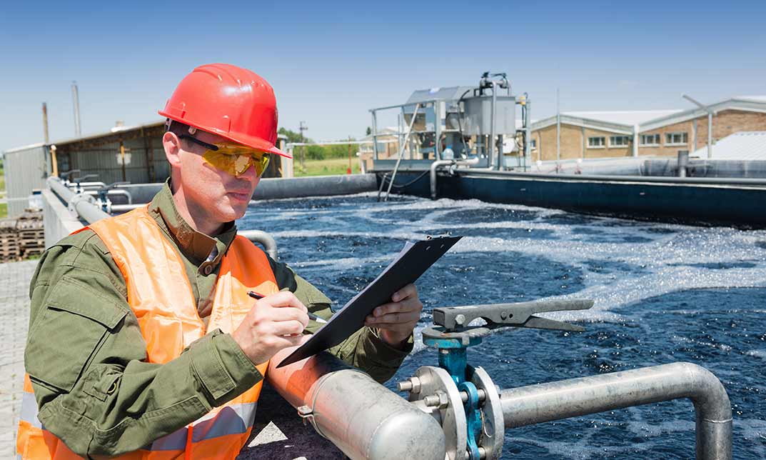
ArcGIS for Hydrology
By Course Cloud
Course Overview Arcgis is the leading geographic information system for working with maps and geographic data. The ArcGIS for Hydrology course is designed to take you from beginner to expert in ArcGis in no time. Through this practical training, you will learn the basic concepts and how to use the main features of GIS software. It will teach you how to perform hydrology-related tasks such as calculating flow direction and creating segments for streaming vertices, through video and instructor-led guidance. This course is suitable for complete beginners and aspiring Hydrology Technicians. There are no specific entry requirements for this course, however an understanding of Windows software is ideal, and you will need to have ArcGis software installed on your computer or laptop. This best selling ArcGIS for Hydrology has been developed by industry professionals and has already been completed by hundreds of satisfied students. This in-depth ArcGIS for Hydrology is suitable for anyone who wants to build their professional skill set and improve their expert knowledge. The ArcGIS for Hydrology is CPD-accredited, so you can be confident you're completing a quality training course will boost your CV and enhance your career potential. The ArcGIS for Hydrology is made up of several information-packed modules which break down each topic into bite-sized chunks to ensure you understand and retain everything you learn. After successfully completing the ArcGIS for Hydrology, you will be awarded a certificate of completion as proof of your new skills. If you are looking to pursue a new career and want to build your professional skills to excel in your chosen field, the certificate of completion from the ArcGIS for Hydrology will help you stand out from the crowd. You can also validate your certification on our website. We know that you are busy and that time is precious, so we have designed the ArcGIS for Hydrology to be completed at your own pace, whether that's part-time or full-time. Get full course access upon registration and access the course materials from anywhere in the world, at any time, from any internet-enabled device. Our experienced tutors are here to support you through the entire learning process and answer any queries you may have via email.
24 Hours Left! Don't Let Year-End Deals Slip Away - Enrol Now! Embark on a journey to unravel the mysteries of Hydrology with the "ArcGIS for Hydrology" bundle! Whether you're an environmentalist, geologist, or simply curious about the world around you, this bundle has something for everyone. With 11 comprehensive courses, you can explore the depths of hydrology, spatial analysis, data visualisation, and more. The first course in the bundle is QLS-endorsed, ensuring that you receive a hardcopy certificate upon completion - a testament to your commitment to learning and expanding your knowledge base. But that's just the beginning. The remaining 10 courses are CPD-QS accredited, which means you can be sure that you're gaining valuable insights and knowledge from the best in the industry. Through the bundle, you'll learn about a range of tools, techniques, and methodologies that will enhance your understanding of hydrology and enable you to create impactful solutions. From spatial data visualisation and machine learning to web scraping and mapping dam levels, the bundle covers everything you need to know to be successful. So, whether you're a seasoned professional or a curious beginner, join the ArcGIS for Hydrology bundle and immerse yourself in a world of knowledge and discovery. Let the courses take you on an enriching journey, expanding your mind and providing you with the skills and insights necessary to make a positive impact in the world of Hydrology. Enrol right now! This ArcGIS for Hydrology Bundle Package includes: Course 01: Diploma in ArcGIS for Hydrology at QLS Level 4 10 Premium Additional CPD QS Accredited Courses - Course 01: QGIS Cartography Course 02: Spatial Analysis in ArcGIS Course 03: Remote Sensing in ArcGIS Course 04: Python Data Science Course 05: Business Intelligence and Data Mining Diploma Course 06: Spatial Data Visualization and Machine Learning in Python Level 4 Course 07: Create Smart Maps in Python and Leaflet Level 3 Course 08: Web Scraping and Mapping Dam Levels in Python and Leaflet Level 4 Course 09: Maps in R Shiny and Leaflet Course 10: The Basics of ArcGIS for Hydrology Why Prefer This ArcGIS for Hydrology Bundle? You will receive a completely free certificate from the Quality Licence Scheme Option to purchase 10 additional certificates accredited by CPD Get a free Student ID Card - (£10 postal charges will be applicable for international delivery) Free assessments and immediate success results 24/7 Tutor Support After taking this ArcGIS for Hydrology bundle courses, you will be able to learn: Develop a deep understanding of hydrology and its applications Master the use of ArcGIS and QGIS for cartography and spatial analysis Learn how to use Python for data science, machine learning, and web scraping Enhance your data visualisation skills in ArcGIS and Python Gain expertise in creating smart maps and web applications using Leaflet and R Shiny Understand the basics of hydrology in ArcGIS for beginners Earn QLS-endorsed and CPD-QS accredited certificates to showcase your skills and knowledge. ***Curriculum breakdown of ArcGIS for Hydrology*** Section 01: Introduction to ArcGIS software Introduction to GIS Introduction to ArcGIS software Selection by Location, attributes, clip features and tables to Excel Performing actions on the data: change the projections, dissolve, clip From .TXT and .DXF to shapefile Calculations with attribute table and KML files in ArcMap Export from ArcMap to PDF ArcScene 3D GIS Example Test AutoCAD fixing polygon coordinates Section 02: ArcGIS for Hydrology Download hydrological data Calculate flow direction and flow accumulation Watershed delineation Clip layers to watershed boundary Stream segments and catchments areas Stream order convert to vector Spatial join to catchments Join stream id to stream order Map data and initial layout Add and format map elements How is the ArcGIS for HydrologyBundle Assessment Process? You have to complete the assignment questions given at the end of the course and score a minimum of 60% to pass each exam. Our expert trainers will assess your assignment and give you feedback after you submit the assignment. You will be entitled to claim a certificate endorsed by the Quality Licence Scheme after you successfully pass the exams. CPD 220 CPD hours / points Accredited by CPD Quality Standards Who is this course for? This bundle is perfect for: Environmentalists, geologists, hydrologists, and scientists GIS professionals, software engineers, and developers Students and researchers in the fields of hydrology and environmental sciences Anyone interested in learning about hydrology and its practical applications. Career path Here are a few options that people explore in this industry: GIS Analyst: £22,000 - £36,000 per year Hydrologist: £25,000 - £45,000 per year Environmental Scientist: £24,000 - £40,000 per year Data Scientist: £35,000 - £75,000 per year Web Developer: £24,000 - £50,000 per year Machine Learning Engineer: £45,000 - £85,000 per year Certificates CPD QS Accredited Certificate Digital certificate - Included Upon successfully completing the Bundle, you will need to place an order to receive a PDF Certificate for each course within the bundle. These certificates serve as proof of your newly acquired skills, accredited by CPD QS. Also, the certificates are recognised throughout the UK and internationally. CPD QS Accredited Certificate Hard copy certificate - Included International students are subject to a £10 delivery fee for their orders, based on their location. Diploma in ArcGIS for Hydrology at QLS Level 4 Hard copy certificate - Included

48-Hour Knowledge Knockdown! Prices Reduced Like Never Before! Have you ever looked at a map and wondered how it was created? Have you ever wanted to gain the skills to analyse spatial data? Look no further than our Spatial Analysis in ArcGIS bundle. With our QLS-endorsed Spatial Analysis in ArcGIS course, you'll gain a deep understanding of geographic information systems and how to utilise ArcGIS software for spatial data analysis. Plus, receive a free QLS hardcopy certificate upon completion, an essential addition to your credentials. But the learning doesn't stop there. Our bundle includes ten more relevant courses, all CPD-QS accredited. From ArcGIS for Hydrology to Web Scraping and Mapping Dam Levels in Python and Leaflet, you'll gain a comprehensive skill set in the field of spatial analysis. Don't just take our word for it. Our courses have been meticulously designed by experienced people to provide you with a theoretical understanding of the subject matter. And with our user-friendly platform, you can learn at your own pace and convenience. Unlock the power of spatial analysis with our bundle today. Enrol now and start your journey towards becoming a skilled spatial analyst. This Spatial Analysis in ArcGIS Bundle Package includes: Course 01: Award in Spatial Analysis in ArcGIS at QLS Level 2 10 Premium Additional CPD QS Accredited Courses - Course 01: ArcGIS for Hydrology Course 02: Remote Sensing in ArcGIS Course 03: QGIS Cartography Course 04: Business Intelligence and Data Mining Diploma Course 05: Python Data Science Course 06: Spatial Data Visualization and Machine Learning in Python Level 4 Course 07: Web Scraping and Mapping Dam Levels in Python and Leaflet Level 4 Course 08: Learn to Use Python for Spatial Analysis in ArcGIS Course 09: Maps in R Shiny and Leaflet Course 10: The Basics of ArcGIS for Hydrology Why Prefer This Spatial Analysis in ArcGIS Bundle? You will receive a completely free certificate from the Quality Licence Scheme Option to purchase 10 additional certificates accredited by CPD Get a free Student ID Card - (£10 postal charges will be applicable for international delivery) Free assessments and immediate success results 24/7 Tutor Support After taking this Spatial Analysis in ArcGIS bundle courses, you will be able to learn: Develop a comprehensive understanding of spatial analysis and its applications in the industry. Gain practical experience using ArcGIS software for spatial data analysis and hydrology. Learn to use remote sensing techniques in ArcGIS for data collection and analysis. Master the art of cartography using QGIS software. Gain expertise in business intelligence, data mining, and data science using Python. Explore spatial data visualisation and machine learning using Python. Learn how to use R Shiny and Leaflet for creating interactive maps. ***Curriculum breakdown of Spatial Analysis in ArcGIS*** Module 01: Point Density Analysis Module 02: Raster Calculator and Vector Isolation Module 03: Raster to Topography Module 04: Raster Reclassification Module 05: Raster Overlay Module 06: Slope Analysis and Hydrology tools Module 07: Introduction to TIFF Files Module 08: Introduction to 3D Surfaces Module 09: Satellite Images and TIN Surfaces Module 10: Exercise How is the Spatial Analysis in ArcGIS Bundle Assessment Process? You have to complete the assignment questions given at the end of the course and score a minimum of 60% to pass each exam. Our expert trainers will assess your assignment and give you feedback after you submit the assignment. You will be entitled to claim a certificate endorsed by the Quality Licence Scheme after you successfully pass the exams CPD 160 CPD hours / points Accredited by CPD Quality Standards Who is this course for? Professionals looking to expand their skill set in the field of spatial analysis. Graduates seeking to enhance their employability in the GIS industry. Individuals seeking to understand spatial data analysis for research purposes. Students pursuing a degree in GIS or a related field. Career path This bundle will be beneficial for anyone looking to pursue a career as: GIS Analyst: £22,000 - £35,000 per annum. GIS Developer: £30,000 - £50,000 per annum. Spatial Data Scientist: £30,000 - £70,000 per annum. Data Analyst: £25,000 - £40,000 per annum. Business Intelligence Analyst: £35,000 - £60,000 per annum. Hydrologist: £25,000 - £40,000 per annum. Certificates Award in Spatial Analysis in ArcGIS at QLS Level 2 Hard copy certificate - Included After successfully completing the course, you can order an original hardcopy Certificate of Achievement endorsed by the Quality Licence Scheme. This certificate will be delivered to your home, free of charge. To obtain the additional Quality Licence Scheme Endorsed Certificate, you will need to pay the corresponding fee based on the level of the courses: Level 1: £59 Level 2: £79 Level 3: £89 Level 4: £99 Level 5: £119 Level 6: £129 Level 7: £139 CPD QS Accredited Certificate Digital certificate - £10 Upon successfully completing the Bundle, you will need to place an order to receive a PDF Certificate for each course within the bundle. These certificates serve as proof of your newly acquired skills, accredited by CPD QS and will cost you £10 for each course. Also, the certificates are recognised throughout the UK and internationally. CPD QS Accredited Certificate Hard copy certificate - £29 International students are subject to a £10 delivery fee for their orders, based on their location.
48-Hour Knowledge Knockdown! Prices Reduced Like Never Before! This Award in Remote Sensing in ArcGIS at QLS Level 2 course is endorsed by The Quality Licence Scheme and accredited by CPDQS (with 60 CPD points) to make your skill development & career progression more accessible than ever! Are you looking to improve your current abilities or make a career move? If yes, our unique Remote Sensing in ArcGIS at QLS Level 2 course might help you get there! It is an expertly designed course which ensures you learn everything about the topic thoroughly. Expand your expertise with high-quality training from the Remote Sensing in ArcGIS at QLS Level 2 course. Due to Remote Sensing in ArcGIS at QLS Level 2's massive demand in the competitive market, you can use our comprehensive course as a weapon to strengthen your knowledge and boost your career development. Learn Remote Sensing in ArcGIS at QLS Level 2 from industry professionals and quickly equip yourself with the specific knowledge and skills you need to excel in your chosen career. The Remote Sensing in ArcGIS at QLS Level 2 course is broken down into several in-depth modules to provide you with the most convenient and rich learning experience possible. Upon successful completion of the Remote Sensing in ArcGIS at QLS Level 2 course, an instant e-certificate will be exhibited in your profile that you can order as proof of your skills and knowledge. Add these amazing new skills to your resume and boost your employability by simply enrolling in this Remote Sensing in ArcGIS at QLS Level 2 course. This Remote Sensing in ArcGIS at QLS Level 2 training can help you to accomplish your ambitions and prepare you for a meaningful career. So, join us today and gear up for excellence! Why Prefer This Remote Sensing in ArcGIS at QLS Level 2 Course? Opportunity to earn a certificate endorsed by the Quality Licence Scheme & another accredited by CPDQS which is completely free. Get a free student ID card! (£10 postal charge will be applicable for international delivery) Innovative and engaging content. Free assessments 24/7 tutor support. Take a step toward a brighter future! *** Course Curriculum *** Here is the curriculum breakdown of the Remote Sensing in ArcGIS at QLS Level 2 course: Module 01: Remote sensing, satellite images, spectral bands introduction Module 02: Layers stacking satellite images Module 03: Georeferencing satellite images Module 04: Introduction to geoprocessing raster tools Module 05: Raster Analysis Functions Module 06: Georeferencing toposheet Module 07: Site suitability using weighted overlay analysis - part 1 Module 08 Site suitability using weighted overlay analysis - part 2 Module 09: Watershed Delineation from DEM Module 10: Unsupervised classification Assessment Process You have to complete the assignment questions given at the end of the course and score a minimum of 60% to pass each exam. Our expert trainers will assess your assignment and give you feedback after you submit the assignment. You will be entitled to claim a certificate endorsed by the Quality Licence Scheme after you have completed all of the Award in Remote Sensing in ArcGIS at QLS Level 2 exams. CPD 60 CPD hours / points Accredited by CPD Quality Standards Who is this course for? This Remote Sensing in ArcGIS at QLS Level 2 course is perfect for highly motivated people who want to improve their technical skills and prepare for the career they want! Requirements Remote Sensing in ArcGIS at QLS Level 2 No prior background or expertise is required. Career path The Remote Sensing in ArcGIS at QLS Level 2 course will boost your CV and aims to help you get the job or even the long-awaited promotion of your dreams. Certificates Award in Remote Sensing in ArcGIS at QLS Level 2 Hard copy certificate - Included Show off Your New Skills with a Certificate of Completion After successfully completing the Award in Remote Sensing in ArcGIS at QLS Level 2, you can order an original hardcopy certificate of achievement endorsed by the Quality Licence Scheme andalso you can order CPDQSAccredited Certificate that is recognised all over the UK and also internationally. The certificates will be home-delivered, completely free of cost. CPDQS Accredited Certificate Digital certificate - Included
48-Hour Knowledge Knockdown! Prices Reduced Like Never Before! This Award in Spatial Analysis in ArcGIS at QLS Level 2 course is endorsed by The Quality Licence Scheme and accredited by CPDQS (with 60 CPD points) to make your skill development & career progression more accessible than ever! Are you looking to improve your current abilities or make a career move? If yes, our unique Spatial Analysis in ArcGIS at QLS Level 2 course might help you get there! It is an expertly designed course which ensures you learn everything about the topic thoroughly. Expand your expertise with high-quality training from the Spatial Analysis in ArcGIS at QLS Level 2 course. Due to Spatial Analysis in ArcGIS at QLS Level 2's massive demand in the competitive market, you can use our comprehensive course as a weapon to strengthen your knowledge and boost your career development. Learn Spatial Analysis in ArcGIS at QLS Level 2 from industry professionals and quickly equip yourself with the specific knowledge and skills you need to excel in your chosen career. The Spatial Analysis in ArcGIS at QLS Level 2 course is broken down into several in-depth modules to provide you with the most convenient and rich learning experience possible. Upon successful completion of the Spatial Analysis in ArcGIS at QLS Level 2 course, an instant e-certificate will be exhibited in your profile that you can order as proof of your skills and knowledge. Add these amazing new skills to your resume and boost your employability by simply enrolling in this Spatial Analysis in ArcGIS at QLS Level 2 course. This Spatial Analysis in ArcGIS at QLS Level 2 training can help you to accomplish your ambitions and prepare you for a meaningful career. So, join us today and gear up for excellence! Why Prefer This Spatial Analysis in ArcGIS at QLS Level 2 Course? Opportunity to earn a certificate endorsed by the Quality Licence Scheme & another accredited by CPDQS which is completely free. Get a free student ID card! (£10 postal charge will be applicable for international delivery) Innovative and engaging content. Free assessments 24/7 tutor support. Take a step toward a brighter future! *** Course Curriculum *** Here is the curriculum breakdown of the Spatial Analysis in ArcGIS at QLS Level 2 course: Module 01: Point Density Analysis Module 02: Raster Calculator and Vector Isolation Module 03: Raster to Topography Module 04: Raster Reclassification Module 05: Raster Overlay Module 06: Slope Analysis and Hydrology tools Module 07: Introduction to TIFF Files Module 08: Introduction to 3D Surfaces Module 09: Satellite Images and TIN Surfaces Module 10: Exercise Assessment Process You have to complete the assignment questions given at the end of the course and score a minimum of 60% to pass each exam. Our expert trainers will assess your assignment and give you feedback after you submit the assignment. You will be entitled to claim a certificate endorsed by the Quality Licence Scheme after you have completed all of the Award in Spatial Analysis in ArcGIS at QLS Level 2 exams. CPD 60 CPD hours / points Accredited by CPD Quality Standards Who is this course for? This Spatial Analysis in ArcGIS at QLS Level 2 course is perfect for highly motivated people who want to improve their technical skills and prepare for the career they want! Requirements Spatial Analysis in ArcGIS at QLS Level 2 No prior background or expertise is required. Career path The Spatial Analysis in ArcGIS at QLS Level 2 course will boost your CV and aims to help you get the job or even the long-awaited promotion of your dreams. Certificates Award in Spatial Analysis in ArcGIS at QLS Level 2 Hard copy certificate - Included Show off Your New Skills with a Certificate of Completion After successfully completing the Award in Spatial Analysis in ArcGIS at QLS Level 2, you can order an original hardcopy certificate of achievement endorsed by the Quality Licence Scheme andalso you can order CPDQSAccredited Certificate that is recognised all over the UK and also internationally. The certificates will be home-delivered, completely free of cost. CPDQS Accredited Certificate Digital certificate - Included