- Professional Development
- Medicine & Nursing
- Arts & Crafts
- Health & Wellbeing
- Personal Development
471 Courses
ArcGIS Desktop for Spatial Analysis: Go from Basic to Pro
By Packt
Gain proficiency in the mastery of Geographic Information Systems (GIS) via ArcGIS Desktop
Master GIS: ArcGIS for Hydrology, Spatial Analysis, Remote Sensing & Cartography
(47)By Academy for Health and Fitness
***24 Hour Limited Time Flash Sale*** Master GIS: ArcGIS for Hydrology, Spatial Analysis, Remote Sensing & Cartography Admission Gifts FREE PDF & Hard Copy Certificate| PDF Transcripts| FREE Student ID| Assessment| Lifetime Access| Enrolment Letter Have you ever dreamed of turning your love for maps and data into a fulfilling career? The geospatial science field is booming in the UK, but a recent study by the Chartered Institute of Environmental Management revealed a shocking fact: 72% of environmental consultancies are struggling to find qualified professionals with the right GIS and data analysis skills. That's where our Master GIS program comes in! This Master GIS program provides in-depth training on ArcGIS, the industry-standard GIS software. You'll master essential skills like spatial analysis, remote sensing for data collection, and creating professional maps using both ArcGIS and open-source QGIS. Additionally, you'll gain expertise in Python programming, data visualisation, and web mapping, making you a highly sought-after geospatial professional. With this Master GIS: ArcGIS for Hydrology, Spatial Analysis, Remote Sensing & Cartography bundle, you will get 20 CPD Accredited PDF Certificates, Hard Copy Certificates, and our exclusive student ID card, all absolutely free. Courses Are Included In this Master GIS: ArcGIS for Hydrology, Spatial Analysis, Remote Sensing & Cartography Career Bundle: Course 01: Diploma in ArcGIS for Hydrology at QLS Level 4 Course 02: Award in Spatial Analysis in ArcGIS at QLS Level 2 Course 03: Remote Sensing in ArcGIS Course 04: QGIS Cartography Course 05: Business Intelligence and Data Mining Diploma Course 06: Python Data Science Course 07: Spatial Data Visualization and Machine Learning in Python Level 4 Course 08: Web Scraping and Mapping Dam Levels in Python and Leaflet Level 4 Course 09: Maps in R Shiny and Leaflet Course 10: Create Smart Maps in Python and Leaflet Level 3 Course 11: Advanced Diploma in Geology Course 12: Structural Geology, Tectonics & Rock Mechanics Course 13: Geospatial Technology, Remote Sensing and Web Mapping Course 14: Environmental Management Course 15: Environmental Law Course 16: Carbon Literacy Project Course 17: Forensic Anthropology Course 18: Autocad Design Course 19: Meteorology Course 20: Architectural Studies Invest in Your Future: Whether you're looking to launch a new career in GIS or enhance your existing skillset, this course bundle is your perfect starting point. Take your first step towards a rewarding career - enrol today! Learning Outcomes of Master GIS: ArcGIS for Hydrology Apply advanced ArcGIS techniques for hydrological analysis. Conduct spatial analysis to uncover hidden patterns in geospatial data. Utilise remote sensing imagery to extract valuable information. Create professional and informative maps using ArcGIS and QGIS. Analyse and visualise spatial data using Python libraries. Develop interactive web maps using Python and Leaflet. Why Choose Us? Get a Free CPD Accredited Certificate upon completion of Master GIS: ArcGIS for Hydrology Get a free student ID card with Master GIS: ArcGIS for Hydrology Training program (£10 postal charge will be applicable for international delivery) The Master GIS: ArcGIS for Hydrology is affordable and simple to understand This course is entirely online, interactive lesson with voiceover audio Get Lifetime access to the Master GIS: ArcGIS for Hydrology course materials The Master GIS: ArcGIS for Hydrology comes with 24/7 tutor support Take a step toward a brighter future! *** Course Curriculum *** Course 01: Diploma in ArcGIS for Hydrology at QLS Level 4 Section 01: Introduction To ArcGIS Software Introduction to ArcGIS software Selection by Location, attributes, clip features and tables to Excel Performing actions on the data: change the projections, dissolve, clip From .TXT and .DXF to shapefile Calculations with attribute table and KML files in ArcMap Export from ArcMap to PDF ArcScene 3D GIS Example Test AutoCAD fixing polygon coordinates Section 02: ArcGIS For Hydrology Download hydrological data Calculate flow direction and flow accumulation Watershed delineation Clip layers to watershed boundary Stream segments and catchments areas Stream order convert to vector Spatial join to catchments Join stream id to stream order Map data and initial layout Add and format map elements Course 02: Award in Spatial Analysis in ArcGIS at QLS Level 2 Module 01: Point Density Analysis Module 02: Raster Calculator and Vector Isolation Module 03: Raster to Topography Module 04: Raster Reclassification Module 05: Raster Overlay Module 06: Slope Analysis and Hydrology tools Module 07: Introduction to TIFF Files Module 08: Introduction to 3D Surfaces Module 09: Satellite Images and TIN Surfaces Module 10: Exercise Course 03: Remote Sensing in ArcGIS Module 01: Remote sensing, satellite images, spectral bands introduction Module 02: Layers stacking satellite images Module 03: Georeferencing satellite images Module 04: Introduction to geoprocessing raster tools Module 05: Raster Analysis Functions Module 06: Georeferencing toposheet Module 07: Site suitability using weighted overlay analysis - part 1 Module 08 Site suitability using weighted overlay analysis - part 2 Module 09: Watershed Delineation from DEM Module 10: Unsupervised classification =========>>>>> And 17 More Courses <<<<<========= How will I get my Certificate? After successfully completing the course, you will be able to order your Certificates as proof of your achievement. PDF Certificate: Free (Previously it was £12.99*20 = £259) CPD Hard Copy Certificate: Free ( For The First Course: Previously it was £29.99) QLS Endorsed Hard Copy Certificate: £79) CPD 200 CPD hours / points Accredited by CPD Quality Standards Who is this course for? Anyone interested in learning more about the topic is advised to take this bundle. This bundle is ideal for: GIS enthusiasts Environmental scientists Urban planners Data analysts Geographers Requirements You will not need any prior background or expertise to enrol in this course. Career path After completing this course, you are to start your career or begin the next phase of your career. GIS Analyst Cartographer Environmental Consultant Data Scientist Web Developer Planner Certificates CPD Accredited Digital Certificate Digital certificate - Included Upon passing the Course, you need to order a Digital Certificate for each of the courses inside this bundle as proof of your new skills that are accredited by CPD QS for Free. CPD Accredited Hard Copy Certificate Hard copy certificate - Included Please note that International students have to pay an additional £10 as a shipment fee. Award in Spatial Analysis in ArcGIS at QLS Level 2 Hard copy certificate - £79 Please note that International students have to pay an additional £10 as a shipment fee.

WhatsUp Gold training course description A hands on course focusing on network management using WhatsUp Gold. What will you learn Discover devices using WhatsUp Gold. Use WhatsUp Gold. Poll and monitor devices using WhatsUp Gold. Create Alarms, alerts and reports. Diagnose faults using WhatsUp Gold. Administrate a WhatsUp Gold system. WhatsUp Gold training course details Who will benefit: Technical staff working with WhatsUp Gold. Prerequisites: None. Duration 2 days WhatsUp Gold for engineers Getting started with WhatsUp Gold Starting WhatsUp Gold, manual discovery, automatic discovery, controlling IP discovery, mapping network devices. Hands on Using WhatsUp Gold. Agents Configuring Cisco devices for SNMP support, communities, traps, syslog. MIBs. Hands on Device discovery. Adding devices. Customising maps. Using WhatsUp Gold Polling, obtaining MIB information, MIB walking, Active monitors, critical monitors, passive monitors. Hands on Monitoring devices. Groups. MIB walking. SNMP trap monitor. Syslog monitor. Alarms Actions, Alert centre, thresholds, actions on events. Hands on Using the alert centre. Web tools. Reports Creating reports, automatic reports, customising reports. Hands on Performance reports. Graphs. Administration Users, backups, the database. Hands on Adding a user. Backups.

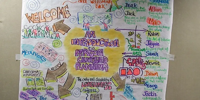
FACILITATION SKILLS: PERSON CENTRED PLANNING
By Inclusive Solutions
Person Centred Planning: the act of listening to each other creates relationship and strengthening trust and inclusion within the team. If well facilitated In creating a shared vision, groups of people build a sense of commitment together. They develop images of the future they want to create together, along with the values that will be important in getting there and the goals they want to see achieved along the way. Course Category Person Centred Planning Team Building and Leadership Description How to facilitate Person Centred Planning? How is it different from any other kind of meeting or planning? Person Centred working is great – but how exactly is it facilitated? How does it differ from ‘chairing a meeting” What skills and processes enable the group to work together effectively and avoid going off at tangents or dissolving into an unfocussed ‘discussion’ Person Centred Planning: the act of listening to each other creates relationship and strengthening trust and inclusion within the team. If well facilitated In creating a shared vision, groups of people build a sense of commitment together. They develop images of the future they want to create together, along with the values that will be important in getting there and the goals they want to see achieved along the way. Making inclusive action plans using full participation and graphic facilitation Drawing on the planning tools MAPS and PATH (Pearpoint, Forest and OBrien 1997) and other facilitation sources we use both process and graphic facilitation to enable the group to build their picture of what they would love to see happening within their organisation/community in the future and we encourage this to be a positive naming, not just a list of the things they want to avoid. In this training we make this facilitation explicit and attempt to model, teach and enable practice of key skills and processes. Jack Pearpoint, Marsha Forest and John O’Brien developed these innovative PCP approaches in North America and they are being used successfully in many parts of the UK. The planning can focus on an individual, group or organisation and provides a powerful problem solving opportunity, which is flexible and robust enough for many occasions. Tell the story, find the dream, touch the nightmare, and explore who you are, what are the gifts and strengths of the person or group, what are the needs of those present and what is the action plan for the future? Testimonials Learning Objectives Participants understand group and graphic facilitation processes for Person Centred Planning Participants have skills and confidence to facilitate PATH/MAP processes Participants learn graphic as well as process facilitation skills. Strengthens practitioners inclusive practice Provides additional tools for those involved in inclusive work in schools and the wider community Further develop problem solving and planning skills Who Is It For ? Person Centred Planning Facilitators Multi Agency Teams Social workers CAMHS teams Year Managers Primary and secondary staff teams Early Years and School based Practitioners Heads and Deputies SENCOs Advanced Skills Teachers Primary and secondary teachers Local Authority Support Services Voluntary Organisations Course Content The course answers the questions: Need to find new ways to facilitate Planning? How to facilitate Person Centred Planning? How is it different to any other kind of meeting or planning? Person Centred working is great – but how exactly is it facilitated? What are the skills and processes that will make the group work really well and a wonderful graphic to be created? Bored with annual reviews, transition plans and review meetings? Want to find a way of making meetings and planning feel more real and engaging? Need an approach, which engages a young person respectfully together with his or her family and friends? Want the ultimate visual record of the process of a meeting, which will help everyone, keep track? Want to problem solve and plan for the future of a small or large group, service or organisation up to the size of an LA? Inclusive Solutions offer an introductory day to facilitating person centred planning or a 3 – 10 session course which is practical as well as values based. Participants will receive direct individualised coaching and training. We will cover: Group and Graphic Facilitation processes Use of music and dramatic participation methodology The person being at the centre Family members and friends being full partners Planning reflecting the person’s capacities, what is important to the person and specifying the support they require to make a full contribution to their community Planning building a shared commitment to action that will uphold the person’s rights Planning leading to continual listening, learning and action and helping the person get what they want out of life. Essential Lifestyle Planning, PATH MAPS Personal Futures Planning
OpenView training course description A hands-on course focusing on network management using HP OpenView network node manager on Microsoft Windows or UNIX. What will you learn Recognise the benefits of ADSL. Describe the network management architecture. Use HP OpenView. Diagnose faults using HP OpenView. Recognise the MIB structure. OpenView training course details Who will benefit: Technical staff wanting to learn DNS. Prerequisites: TCP/IP Foundation Duration 2 days OpenView training course contents Network management What is network management?, Benefits, issues, demonstration. Getting started with HP OpenView Starting HP OpenView, IP discovery, IP monitoring, controlling IP discovery. Using HP OpenView Mapping devices, map layouts, maps and submaps, objects and symbols, object attributes, colour codings, polling. Agents Configuring Cisco devices for SNMP support, communities, traps, syslog. Parts of SNMP SNMP architecture, MIB's, The protocol. HP OpenView SNMP configuration HP OpenView alarm browser HP OpenView alarms, alarm categories, filtering alarms, alarm details window. MIB's MIB1, MIB2, The MIB2 groups, additional MIB's, MIB compilers, vendor MIB's. HP OpenView MIB loader and browser. Monitoring devices Polling, obtaining MIB information. Diagnostic tools Poll node, the ping window, protocol test, locate route HP OpenView fault management Alarms, polling, fault management, setting thresholds and configuring traps.
NNMi for engineers training course description A hands on course focusing on network management using Network Node Manager (NNMi) on Microsoft Windows or UNIX. What will you learn Describe the network management architecture. Use NNMi. Diagnose faults using NNMi. Recognise the MIB structure. NNMi for engineers training course details Who will benefit: Network administrators. Network operators. Those wishing to find out more about how their NNMi works. Prerequisites: TCP/IP foundation for engineers Duration 2 day NNMi for engineers training course content Network management What is network management? Benefits, issues, demonstration. Getting started with NNMi Starting NNMi, IP discovery, IP monitoring, controlling IP discovery. Using NNMi Mapping devices, map layouts, maps and submaps, objects and symbols, object attributes, colour codings, polling. Agents Configuring Cisco devices for SNMP support, communities, traps, syslog. Parts of SNMP SNMP architecture, MIBs, The protocol. NNMi SNMP configuration NNMi alarm browser NNMi alarms, alarm categories, filtering alarms, alarm details window. MIBs MIB1, MIB2, The MIB2 groups, additional MIBs, MIB compilers, vendor MIBs. NNMi MIB loader and browser. Monitoring devices Polling, obtaining MIB information. Diagnostic tools Poll node, the ping window, protocol test, locate route NNMi fault management Alarms, polling, fault management, setting thresholds and configuring traps.
Definitive Nagios training course description Nagios is an open source application designed to provide system and network monitoring. This hands on course gives a comprehensive coverage of using Nagios to provide monitoring of Linux, Windows and network devices. The course is based on Nagios core but contact us if you would like Nagios XI. What will you learn Install Nagios. Configure Nagios. Monitor Windows, Linux and Cisco (and other network equipment) using Nagios. Configure notifications Definitive Nagios training course details Who will benefit: Technical staff working with Nagios. Prerequisites: None. Duration 2 days Definitive Nagios for engineers Nagios architecture Downloading Nagios, Installing Nagios, Nagios core, plugins, frontends, addons. Nagios XI. Nagios Fusion. Hands on Installing Nagios. Getting started with Nagios Nagios files, nagios.cfg, minimal.cfg. Starting and stopping Nagios. Hands on Controlling Nagios. Using Nagios Nagios web interface. Maps, Hosts, host groups, services, service groups, problems. Reports. Configuration. Hands on Using the web interface. Monitoring Linux systems SSH, NRPE. Hands on Monitoring Linux system health. Monitoring Windows systems Installing NSClient++, Configuring NSClient++, check_nt plugin, monitoring uptime, CPU, memory, disks, services, processes. Hands on Monitoring Windows system health. Monitoring network devices SNMP architecture, MIBs. Polling. Hands on Configuring Nagios for SNMP. Agents Configuring Cisco devices for SNMP support, communities, traps, syslog. Hands on Monitoring network devices. Nagios alerts and notifications SNMP traps. Email notifications, SMS alerts other messaging
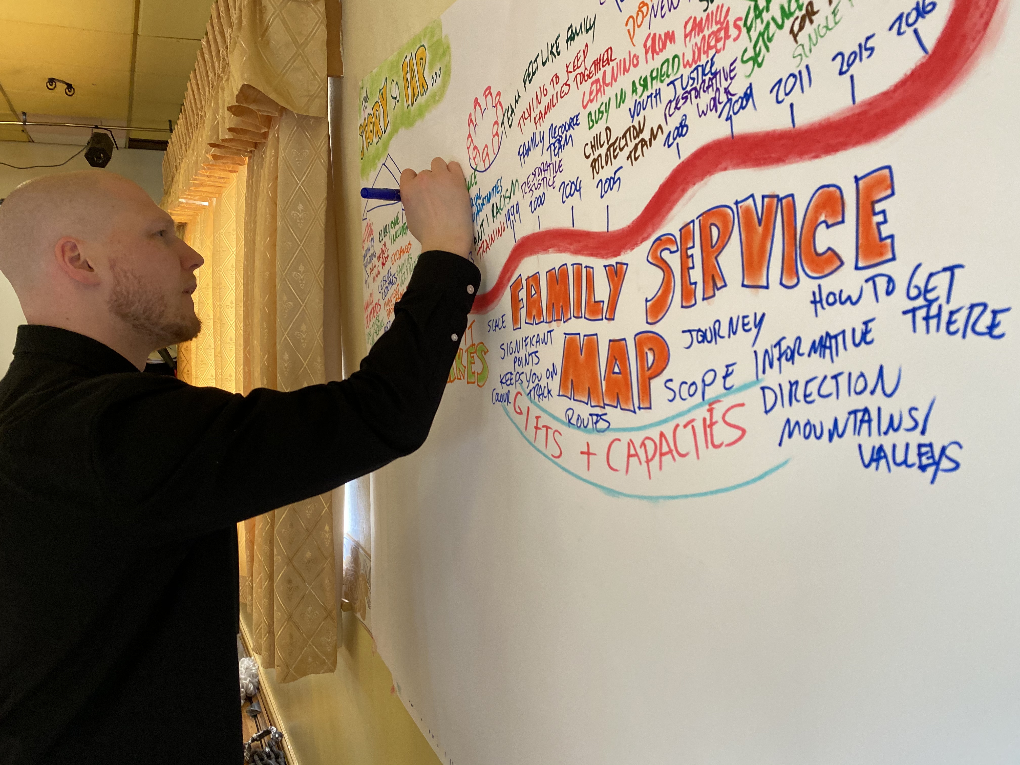
MAP – MAKING AN ACTION PLAN WITH PERSON CENTRED PROCESSES
By Inclusive Solutions
To facilitate a group, family, team or organisation in thinking together around a given challenge or issue here is an opportunity to experience for real the person centred, futures planning tool – MAP (Pearpoint, Forest et. al. 1989). This is a process not a training day. Let us facilitate your planning and refocus your story whilst strengthening you and your group. This tool uses both process and graphic facilitation to help any group develop a shared vision and then to make a start on working out what they will need to do together to move towards that vision. MAPS are great for threshold moments. Is your team stuck? Want to move on, haunted by the past cannot get any useful dialogue about the future? Facing a challenging transition into a new school or setting? Leaving school? Bored with annual reviews, transition plans and review meetings? Want to find a way of making meetings and planning feel more real and engaging? Need an approach, which engages a young person respectfully together with his or her family and friends? Want the ultimate visual record of the process of a meeting, which will help everyone, keep track? Want to problem solve and plan for the future of a small or large group, service or organisation up to the size of an LEA Learning Objectives To create a shared vision To talk through the story so far and reflect upon it To name the worse nightmares that will block progress To strengthen the group by focussing on gifts and capacity To detail needs To specify an Action Plan To create a visual graphic record of the whole event Course Content The MAP process has 6 Steps: The story so far. The group is required to think back over the years to describe their collective experience of changes and events over time within their settings. Stories and events are recorded on the graphic. Building Shared Dreams. The group thinks together about what they would love to see happening for children, families and practitioners in their settings if they could have it all. If there were no constraints on time, money, resources, people or anything else what do they see happening in their imaginations? The various ideas that the group comes up with are then recorded in key words, images and colours on the MAP graphic. The purpose of this Step is to give the group a sense of direction, their North Star, an image of the place they want to work towards. Nightmare. In this Step, the group imagines the worst scenarios. What is the opposite of their dreams? How bad could it get? This is a shorter but powerful process that can give some groups more energy than dreaming together. Gifts and Capacity. In this Step the group is asked to take explicit stock of their capacities and what they already have going for them as they begin working towards the vision. This is a strong reminder for any group of the wealth of knowledge and experience that is already and always in the room. Needs. In this Step the group is invited to begin to name some of the needs they will have if they are to move forward to wards the dream and away from the nightmare. Actions. This is the final Step in the MAP and calls for individuals within the group to name a range of very specific actions (however small) that they will take within a definite time scale. This is not a time for declaring good intentions or suggesting good ideas for someone else to do. The purpose of this Step is to end the MAP process with a range of clearly understood actions that carry this planning process forward into the real world.
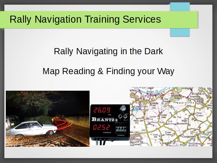
Rallying and Map Reading in the Dark - Hints and Tips for Success Video
By Rally Navigation Training Services
Learn expert tips from Graham Raeburn on navigating night rallies. Master Ordnance Survey maps and gain key insights for confident map reading in the dark.
Photoshop Basics to Essentials Training
By London Design Training Courses
Why Choose Photoshop Basics to Essentials Training Course? Course Link Mastering Photoshop is crucial for securing positions in creative fields such as graphic design, digital design, and user interface (UI) design. Acquiring this skill serves as a foundation to excel in various design programs essential for creative professionals. Duration: 16 hrs. Method: 1-on-1, Personalized attention. Schedule: Tailor your own hours of your choice, available from Monday to Saturday between 9 am and 7 pm. Photoshop Course: Total 16 hrs Module 1: Keyboard and Toolbar Shortcuts Customize toolbars and keyboard shortcuts for efficient workflow Learn essential keyboard shortcuts for faster navigation Module 2: Advanced Layer Management Filter, search, and color code layers for better organization Group and merge layers to streamline your design process Explore Blending Modes for creative effects Module 3: Blending Modes Understand Blending Modes and their usage within layers and effects Apply Blending Modes to enhance your designs Module 4: Layer Comps Discover Layer Comps and their benefits in managing complex designs Create, edit, and update Layer Comps for different design versions Export Layer Comps to PSD, PDF, and JPEG formats Module 5: Drawing Vectors Work with Vector images using shapes and the Pen Tool Use the Direct Selection Tool for precise editing Apply colors and create Clipping Masks with vectors Module 6: Advanced Type Techniques Convert text into Shapes and utilize font style changes with the Pen Tool Use text as a Clipping Mask and create text Outlines Design 3D text for impactful typography Module 7: Advanced Adjustment Layers Master advanced adjustments like Curves, Levels, and Black and White Utilize Selective Color and Gradient Maps for creative color control Module 8: Advanced Selection Techniques Use Smart Radius and Select and Mask for precise selections Learn to select complex objects like hair using Color Range and the Pen Tool Save and manage selections using the Path Panel Module 9: Colorizing Black and White Images Module 10: Displacement Maps Module 11: Advanced Filters Create Trees, Frames, Clouds, and Fire with filters Use Polarized, Wave, and Extrusion for artistic effects like "Japanese Sun" Explore Vanishing Point Filter, Camera RAW, Blur for depth of field, and Filter Gallery Combine 3D text with Vanishing Point for stunning designs Use Liquify for image manipulation Module 12: Introduction to Actions Automate tasks using Photoshop's preset Actions Create your own Actions to save time and effort Module 13: Creating an Animated GIF Learn frame by frame animation Utilize the Timeline to create engaging animated GIFs Learning Outcomes: Master advanced selection techniques, including the Path and Pen Tool, for precise editing. Gain proficiency in advanced layer management and utilize Layer Comps for efficient design organization. Enhance your designs with a deeper understanding and application of Blending Modes. Create visually appealing 3D text and text outlines to add depth and impact to your artwork. Explore advanced Filters like Displacement Maps, Blurs, and Distortion for creative effects. Automate tasks with actions and batch processing, streamlining your workflow. Craft engaging animated GIFs to add dynamic elements to your designs. Skillfully set project requirements by identifying the purpose, target audience, copyright considerations, and project management tasks for successful project execution.