- Professional Development
- Medicine & Nursing
- Arts & Crafts
- Health & Wellbeing
- Personal Development
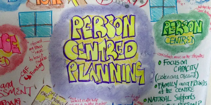
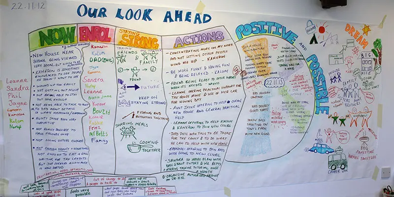
PERSON CENTRED REVIEWS
By Inclusive Solutions
Learn how to carry out a Person Centred Review based on the values of person centred thinking. Course Category Person Centred Planning Inclusion Strategic Work Visioning and Problem Solving Description Person centred planning is a way of expressing a set of inclusive values through a unique range of tools and techniques. The most commonly used person centred tool is a Person Centred Review – and it shows these values in action. All person centred planning tools and processes are driven by a commitment to achieve inclusive outcomes for the person whose plan it is, and the young people involved are always present throughout their planning session. The focus of all person centred approaches is the whole person irrespective of the label they carry. Two people, a process facilitator and a graphic facilitator, typically facilitate plans. The role of the support service staff in this work is as a facilitator not as an expert participant, problem solver, assessor or provider of consultation. Person Centred Reviews like MAPS and PATH are especially effective tools in planning transitions and annual review processes for young people with additional support needs and for through-care planning for young people who are looked after or accommodated. Over time person centred working will reveal areas of unmet need in current provision and thereby inform the ongoing strategic planning within any particular region. Testimonials Be the first…. Learning Objectives To Explore the values underpinning person centred working To show how person centred planning with Person Centred Reviews naturally captures young people’s strengths and capacities A demonstration of how person centred reviews encourage meaningful consultation and participation with young people (particularly for those who cannot make their views known in typical ways To show how Person Centred Planning leads to the building of stronger parent/school partnerships To indicate how person centred planning can promote multi-agency teamwork and shared responsibilities To increase understanding the how of process and graphic facilitation in person centred work. Who Is It For ? Teachers and School Staff Education Services Social Care Staff Health Professionals Transition Coordinators Family Support Workers Link Workers Course Content An introduction to the person centred planning Person Centred Reviews – live demonstrations of process in action followed by real time coaching of facilitation skills. We would stress that this is an introductory day and that participants will be expected to make plans for their own follow up and further practice of the tools covered in the course of the day. If you liked this course you may well like: PERSON CENTRED PLANNING USING PATH AND MAPS
PERSON CENTRED THINKING – EXTREME
By Inclusive Solutions
The Extreme Person Centred Thinking Tools are a set of tools to support dreams, build relationships and connections and promote capacity thinking. The aim of the extreme person centred thinking tools training is not to teach people how to facilitate plans, instead it is about sharing tools that can be used to listen and reflect and creatively involve people in planning their own lives. Online Course now available via Teachable Platform – Person Centred Mindset Learn at your own pace… lots of text and video support Course Category Person Centred Planning Description The Extreme Person Centred Thinking Tools are a set of tools to support dreams, build relationships and connections and promote capacity thinking. The aim of the extreme person centred thinking tools training is not to teach people how to facilitate plans, instead it is about sharing tools that can be used to listen and reflect and creatively involve people in planning their own lives. Many of these tools have been taken from MAPS and PATH, and parts also build on the person centred thinking tools. Testimonials Be the first… Learning Objectives This course will provide participants with an understanding of how to use a range of extreme person centred thinking tools to; Use graphics to facilitate creative conversations Learn from people’s stories and histories Listen to and facilitate dreams and nightmares Think about what is positive and possible Connect people with their communities Facilitate inclusion Who Is It For? Person Centred Planning Facilitators Support Workers / Day Centre Officers / Residential Workers Personal Assistants / Teaching Assistants Families Self Advocates Social Workers CAMHS teams Primary and secondary staff teams SENCOs Local Authority Support Services Course Content The course will introduce participants to a range of tools focused around supporting relationships, realising dreams, connecting people with their communities and capacity thinking. Participants will be coached in using the tools and given the opportunity to practice the tools and their graphic facilitation skills in a safe environment. The course will answer the following questions: How can we use ideas from MAP and PATH in our day to day work? How can I use graphics to facilitate conversations? How can we learn more about the people we support? How can we start to think about connecting people to their communities? If you liked this course you may well like: PERSON CENTRED PLANNING USING PATH AND MAPS
Landscape Architecture Training Course Beginner to Advanced
By ATL Autocad Training London
Who is this course for? This course is ideal for individuals interested in learning landscape architecture, emphasizing the planning, design, and management of various outdoor spaces, such as private gardens, public parks, and commercial landscapes. Click here for more info: Website 1-on-1 training, Monday to Saturday, 9 a.m. to 7 p.m., or call to book. Tailor your 40-hour course Option A: AutoCAD, Sketchup, Vray, and Photoshop. Option B: Rhino, Sketchup, Vray, and Photoshop. Both covering specializes in Planting Plans and Maps. Course Outline - Option A: AutoCAD, Sketchup, Vray, Photoshop (Total: 40 hours) AutoCAD (10 hours): Module 1: Introduction to AutoCAD (2 hours) - Overview of AutoCAD interface and tools - Creating, opening, and saving drawings - Basic drawing and editing commands Module 2: Drawing and Editing (3 hours) - Working with lines, circles, and arcs - Utilizing polylines and polygons - Modifying objects: Move, Copy, Rotate, and Scale Module 3: Precision Drawing (3 hours) - Using coordinate systems for precision - Dimensioning and text incorporation - Hatching and gradients for added detail Module 4: Advanced Tools (2 hours) - Leveraging blocks and attributes - Managing layers and object properties - Creating layouts and preparing for plotting Sketchup (16 hours): (Specializing in Planting Plans, Vegetation Plans, and Maps) Module 1: Introduction to Sketchup (2 hours) - Navigating the Sketchup interface - Grasping basic 2D and 3D modeling concepts - Creating and manipulating objects Module 2: Advanced Modeling (6 hours) - Model intricate garden elements with curves and surfaces - Expertly edit and transform geometry - Specialized focus on Planting Plans, Vegetation Plans, and Maps Module 3: Visualization with Vray (4 hours) - Understanding the Vray rendering engine - Applying materials and textures for realism - Setting up lighting and cameras for realistic rendering Module 4: Image Enhancement with Photoshop (10 hours): - Introduction to Photoshop for design purposes - Editing and enhancing Sketchup and Vray outputs - Creating visually striking presentations Additional Resources: Access free online portfolio design assistance, career growth guidance, and mock interviews to ensure your readiness for the competitive job market. Course Outline - Option B: AutoCAD, Rhino, Vray, Photoshop (Total: 40 hours) AutoCAD (12 hours): Module 1: Introduction to AutoCAD (2 hours) - Overview of AutoCAD interface and tools - Creating, opening, and saving drawings - Basic drawing and editing commands Module 2: Drawing and Editing (3 hours) - Working with lines, circles, and arcs - Utilizing polylines and polygons - Modifying objects: Move, Copy, Rotate, and Scale Module 3: Precision Drawing (3 hours) - Using coordinate systems for precision - Dimensioning and text incorporation - Hatching and gradients for added detail Module 4: Advanced Tools (4 hours) - Leveraging blocks and attributes - Managing layers and object properties - Creating layouts and preparing for plotting Rhino (14 hours): Module 1: Introduction to Rhino (2 hours) - Navigating the Rhino interface - Grasping basic 2D and 3D modeling concepts - Creating and manipulating objects Module 2: Advanced Modeling (6 hours) - Model intricate garden structures with curves and surfaces - Proficiently edit and transform geometry - Build complex 3D structures Module 3: Visualization with Vray (6 hours) - Setting up lights and cameras for garden renders - Exploring rendering settings and options - Post-production and compositing techniques Image Enhancement with Photoshop (8 hours): - Introduction to Photoshop for design purposes - Editing and enhancing Rhino and Vray outputs - Creating visually striking presentations Both Option A and Option B provide comprehensive training in essential design software, with the choice between specialization in Sketchup (Option A) or a broader skill set with Rhino (Option B). Additionally, both options offer access to valuable resources for career preparation. When Can I Book this Training Course? Personalized 1-on-1 training sessions available, allowing for a tailored learning experience. Pre-book your preferred time slot from Monday to Saturday between 9 a.m. and 7 p.m. Alternatively, call 02077202581 to book over the phone. Training Duration 40-hour training program, with the flexibility to split hours based on your ideal learning schedule. Training Method Choose between in-person Face to Face or Live Online 1-on-1 training. Expect personalized attention, flexible learning pace, and individualized support throughout your training. Live Online sessions available over Zoom for added convenience. Enroll in our 1-on-1 Course Today! Comprehensive Training Program Overview Option A: AutoCAD (10 hours) Sketchup (16 hours) (Specializing in Planting Plans, Vegetation Plans, and Maps) Vray (4 hours) Photoshop (10 hours) Option B: AutoCAD (12 hours) Rhino (14 hours) Vray (6 hours) Photoshop (8 hours) Benefits of Option A: Diverse Skillset: Gain expertise in AutoCAD, Sketchup, Vray, and Photoshop for various design fields. Specialization: Focus on Planting Plans, Vegetation Plans, and Maps within Sketchup. Realistic Renderings: Learn Vray for compelling 3D renderings. Image Editing: Enhance images effectively with Photoshop. Career Readiness: Access resources like portfolio design assistance and mock interviews for job market readiness. Benefits of Option B: Versatile Expertise: Master AutoCAD, Rhino, Vray, and Photoshop for various design disciplines. Advanced 3D Modeling: Excel in complex designs with Rhino and 3ds Max. Quality Renderings: Create impressive 3D renderings with Vray. Image Editing Mastery: Perfect design concepts with Photoshop. Additional Training Course Benefits: Compatible with both Mac and Windows operating systems. Price Assurance for exceptional value. Flexible scheduling from Monday to Sunday, 9 am to 8 pm. Lifetime Email and Phone Support. Assistance in configuring your computer for seamless software installation. Referral Benefits, including special discounts for friend referrals and savings on group training courses.

Data Structures in JavaScript - Master the Fundamentals
By Packt
This course covers essential topics required for working with data structures and algorithms using JavaScript. From basics of data structures and algorithms to key concepts, such as arrays, lists, Big O time-space asymptomatic analysis, trees, and maps, this course will teach you everything with the help of engaging examples and activities.
Citation SEO Training
By iStudy UK
Explore the surefire ways of boosting your website with Citation SEO Training course. Search Engine Optimization is a challenging and longtime process. However, citation makes it fast to rank. The course focuses on the local citation which denotes to the online mention of the name, address, and phone number for a local business. Throughout the course, you will learn how to use citation for ranking your websites. The course shows you the procedures for claiming a business page on Google Map and guides you to create your exact location on Google Map. You will also learn how to get places in the maps section of desktop, mobile and voice searches. The strategies of building Trust Flow and Domain authority of your website will be discussed in the course. Finally, the course also provides you with the instruction for outsourcing the entire process and explains the methods of getting more traffic using the above-mentioned technique. What you'll learn You'll know how to claim a business page on Google Maps You'll know how to use citations to rank your website faster You'll know how to DIY or outsource the entire process You'll know how to get more SEO traffic from these techniques You'll know how to build Trust Flow, Domain Authority and more for your website You'll know how to get placing in the maps section of desktop, mobile & voice searches Requirements You should know how to use a PC at a beginner level Who is the target audience? Online Marketers Local Businesses Anyone with a physical location or P.O. box Anyone who wants to rank better in Google Maps, Bing Maps, Yahoo Maps, Yelp and more Anyone who wants a rush of business by simply claiming a local city for better LOCAL SEO RANKINGS! Introduction FREE 00:02:00 Citation SEO 00:09:00 An Example Citation Setup 00:03:00 Google My Business 00:06:00 Google Review Management & Marketing 00:19:00 The Difference in Citation Websites 00:05:00 Additional Business Sites for Reviews 00:12:00 WhiteSpark for Citation Analysis 00:03:00 Outsource Local Citations 00:05:00 Course Certification

The Complete Flutter and Dart App Development Course
By Packt
Learn Flutter - Google's mobile development framework - and build Flutter iOS and Android apps using a single codebase

48-Hour Knowledge Knockdown! Prices Reduced Like Never Before! Step into the world of geospatial technology with our exclusive QGIS Cartography and ArcGIS bundle. Discover the power of spatial analysis and remote sensing while learning to create smart maps, web scraping, and data visualisation. Whether you're a beginner or an experienced professional, this bundle offers everything you need to enhance your skillset and advance your career. As a bonus, the QGIS Cartography course is QLS-endorsed, ensuring that you receive a hardcopy certificate upon completion, enhancing your credibility in the field. The remaining ten courses are CPD-QS accredited, providing you with industry-recognised certification. Our courses are designed to be accessible to everyone, with no prior experience or technical knowledge required. With our easy-to-follow lectures, you can learn at your own pace and on your own schedule. You'll have access to comprehensive resources, including course materials and support from our expert team. The QGIS Cartography and ArcGIS bundle is the perfect choice for anyone looking to expand their knowledge and enhance their career prospects in the geospatial industry. With our top-rated courses, you'll gain invaluable skills that will set you apart from the competition. So why wait? Enrol now and take the first step towards a brighter future! This QGIS Cartography and ArcGIS Bundle Package includes: Course 01: Diploma in QGIS Cartography at QLS Level 4 10 Premium Additional CPD QS Accredited Courses - Course 01: Spatial Analysis in ArcGIS Course 02: Remote Sensing in ArcGIS Course 03: ArcGIS for Hydrology Course 04: Spatial Data Visualization and Machine Learning in Python Level 4 Course 05: Create Smart Maps in Python and Leaflet Level 3 Course 06: Web Scraping and Mapping Dam Levels in Python and Leaflet Level 4 Course 07: Python Data Science Course 08: Learn to Use Python for Spatial Analysis in ArcGIS Course 09: Maps in R Shiny and Leaflet Course 10: The Basics of ArcGIS for Hydrology Why Prefer This QGIS Cartography and ArcGIS Bundle? You will receive a completely free certificate from the Quality Licence Scheme Option to purchase 10 additional certificates accredited by CPD Get a free Student ID Card - (£10 postal charges will be applicable for international delivery) Free assessments and immediate success results 24/7 Tutor Support After taking this QGIS Cartography and ArcGIS bundle courses, you will be able to learn: Understand the basics of QGIS Cartography and ArcGIS software Learn to perform spatial analysis and remote sensing in ArcGIS Develop skills in creating smart maps and web scraping with Python and Leaflet Learn data visualisation and machine learning in Python Gain expertise in hydrology with ArcGIS Create maps in R Shiny and Leaflet Use Python for spatial analysis in ArcGIS ***Curriculum breakdown of QGIS Cartography*** Section 01: Introduction Section 02: Labels Section 03: Symbology Section 04: Base Layers Section 05: Project Setup Section 06: Water Styling Section 07: Land Styling How is the QGIS Cartography and ArcGIS Bundle Assessment Process? You have to complete the assignment questions given at the end of the course and score a minimum of 60% to pass each exam. Our expert trainers will assess your assignment and give you feedback after you submit the assignment. You will be entitled to claim a certificate endorsed by the Quality Licence Scheme after you successfully pass the exams. CPD 220 CPD hours / points Accredited by CPD Quality Standards Who is this course for? Professionals seeking to enhance their skills in geospatial technology Students interested in a career in GIS or related fields Individuals looking to expand their knowledge in QGIS Cartography and ArcGIS software Anyone seeking industry-recognized certification Career path This bundle will be beneficial for anyone looking to pursue a career as: GIS Analyst: £21,000 - £42,000 per annum GIS Technician: £18,000 - £32,000 per annum GIS Manager: £28,000 - £65,000 per annum Remote Sensing Analyst: £25,000 - £50,000 per annum Data Scientist: £25,000 - £80,000 per annum Hydrologist: £25,000 - £50,000 per annum Certificates Diploma in QGIS Cartography at QLS Level 4 Hard copy certificate - Included After successfully completing thecourse, you can order an original hardcopy Certificate of Achievement endorsed by the Quality Licence Scheme. This certificate will be delivered to your home, free of charge. To obtain the additional Quality Licence Scheme Endorsed Certificate, you will need to pay the corresponding fee based on the level of the courses: Level 1: £59 Level 2: £79 Level 3: £89 Level 4: £99 Level 5: £119 Level 6: £129 Level 7: £139 CPD QS Accredited Certificate Digital certificate - £10 Upon successfully completing the Bundle, you will need to place an order to receive a PDF Certificate for each course within the bundle. These certificates serve as proof of your newly acquired skills, accredited by CPD QS and will cost you £10 for each course. Also, the certificates are recognised throughout the UK and internationally. CPD QS Accredited Certificate Hard copy certificate - £29 International students are subject to a £10 delivery fee for their orders, based on their location.

ArcGIS Desktop for Spatial Analysis: Go from Basic to Pro
By Packt
Gain proficiency in the mastery of Geographic Information Systems (GIS) via ArcGIS Desktop
Master GIS: ArcGIS for Hydrology, Spatial Analysis, Remote Sensing & Cartography
(47)By Academy for Health and Fitness
***24 Hour Limited Time Flash Sale*** Master GIS: ArcGIS for Hydrology, Spatial Analysis, Remote Sensing & Cartography Admission Gifts FREE PDF & Hard Copy Certificate| PDF Transcripts| FREE Student ID| Assessment| Lifetime Access| Enrolment Letter Have you ever dreamed of turning your love for maps and data into a fulfilling career? The geospatial science field is booming in the UK, but a recent study by the Chartered Institute of Environmental Management revealed a shocking fact: 72% of environmental consultancies are struggling to find qualified professionals with the right GIS and data analysis skills. That's where our Master GIS program comes in! This Master GIS program provides in-depth training on ArcGIS, the industry-standard GIS software. You'll master essential skills like spatial analysis, remote sensing for data collection, and creating professional maps using both ArcGIS and open-source QGIS. Additionally, you'll gain expertise in Python programming, data visualisation, and web mapping, making you a highly sought-after geospatial professional. With this Master GIS: ArcGIS for Hydrology, Spatial Analysis, Remote Sensing & Cartography bundle, you will get 20 CPD Accredited PDF Certificates, Hard Copy Certificates, and our exclusive student ID card, all absolutely free. Courses Are Included In this Master GIS: ArcGIS for Hydrology, Spatial Analysis, Remote Sensing & Cartography Career Bundle: Course 01: Diploma in ArcGIS for Hydrology at QLS Level 4 Course 02: Award in Spatial Analysis in ArcGIS at QLS Level 2 Course 03: Remote Sensing in ArcGIS Course 04: QGIS Cartography Course 05: Business Intelligence and Data Mining Diploma Course 06: Python Data Science Course 07: Spatial Data Visualization and Machine Learning in Python Level 4 Course 08: Web Scraping and Mapping Dam Levels in Python and Leaflet Level 4 Course 09: Maps in R Shiny and Leaflet Course 10: Create Smart Maps in Python and Leaflet Level 3 Course 11: Advanced Diploma in Geology Course 12: Structural Geology, Tectonics & Rock Mechanics Course 13: Geospatial Technology, Remote Sensing and Web Mapping Course 14: Environmental Management Course 15: Environmental Law Course 16: Carbon Literacy Project Course 17: Forensic Anthropology Course 18: Autocad Design Course 19: Meteorology Course 20: Architectural Studies Invest in Your Future: Whether you're looking to launch a new career in GIS or enhance your existing skillset, this course bundle is your perfect starting point. Take your first step towards a rewarding career - enrol today! Learning Outcomes of Master GIS: ArcGIS for Hydrology Apply advanced ArcGIS techniques for hydrological analysis. Conduct spatial analysis to uncover hidden patterns in geospatial data. Utilise remote sensing imagery to extract valuable information. Create professional and informative maps using ArcGIS and QGIS. Analyse and visualise spatial data using Python libraries. Develop interactive web maps using Python and Leaflet. Why Choose Us? Get a Free CPD Accredited Certificate upon completion of Master GIS: ArcGIS for Hydrology Get a free student ID card with Master GIS: ArcGIS for Hydrology Training program (£10 postal charge will be applicable for international delivery) The Master GIS: ArcGIS for Hydrology is affordable and simple to understand This course is entirely online, interactive lesson with voiceover audio Get Lifetime access to the Master GIS: ArcGIS for Hydrology course materials The Master GIS: ArcGIS for Hydrology comes with 24/7 tutor support Take a step toward a brighter future! *** Course Curriculum *** Course 01: Diploma in ArcGIS for Hydrology at QLS Level 4 Section 01: Introduction To ArcGIS Software Introduction to ArcGIS software Selection by Location, attributes, clip features and tables to Excel Performing actions on the data: change the projections, dissolve, clip From .TXT and .DXF to shapefile Calculations with attribute table and KML files in ArcMap Export from ArcMap to PDF ArcScene 3D GIS Example Test AutoCAD fixing polygon coordinates Section 02: ArcGIS For Hydrology Download hydrological data Calculate flow direction and flow accumulation Watershed delineation Clip layers to watershed boundary Stream segments and catchments areas Stream order convert to vector Spatial join to catchments Join stream id to stream order Map data and initial layout Add and format map elements Course 02: Award in Spatial Analysis in ArcGIS at QLS Level 2 Module 01: Point Density Analysis Module 02: Raster Calculator and Vector Isolation Module 03: Raster to Topography Module 04: Raster Reclassification Module 05: Raster Overlay Module 06: Slope Analysis and Hydrology tools Module 07: Introduction to TIFF Files Module 08: Introduction to 3D Surfaces Module 09: Satellite Images and TIN Surfaces Module 10: Exercise Course 03: Remote Sensing in ArcGIS Module 01: Remote sensing, satellite images, spectral bands introduction Module 02: Layers stacking satellite images Module 03: Georeferencing satellite images Module 04: Introduction to geoprocessing raster tools Module 05: Raster Analysis Functions Module 06: Georeferencing toposheet Module 07: Site suitability using weighted overlay analysis - part 1 Module 08 Site suitability using weighted overlay analysis - part 2 Module 09: Watershed Delineation from DEM Module 10: Unsupervised classification =========>>>>> And 17 More Courses <<<<<========= How will I get my Certificate? After successfully completing the course, you will be able to order your Certificates as proof of your achievement. PDF Certificate: Free (Previously it was £12.99*20 = £259) CPD Hard Copy Certificate: Free ( For The First Course: Previously it was £29.99) QLS Endorsed Hard Copy Certificate: £79) CPD 200 CPD hours / points Accredited by CPD Quality Standards Who is this course for? Anyone interested in learning more about the topic is advised to take this bundle. This bundle is ideal for: GIS enthusiasts Environmental scientists Urban planners Data analysts Geographers Requirements You will not need any prior background or expertise to enrol in this course. Career path After completing this course, you are to start your career or begin the next phase of your career. GIS Analyst Cartographer Environmental Consultant Data Scientist Web Developer Planner Certificates CPD Accredited Digital Certificate Digital certificate - Included Upon passing the Course, you need to order a Digital Certificate for each of the courses inside this bundle as proof of your new skills that are accredited by CPD QS for Free. CPD Accredited Hard Copy Certificate Hard copy certificate - Included Please note that International students have to pay an additional £10 as a shipment fee. Award in Spatial Analysis in ArcGIS at QLS Level 2 Hard copy certificate - £79 Please note that International students have to pay an additional £10 as a shipment fee.

WhatsUp Gold training course description A hands on course focusing on network management using WhatsUp Gold. What will you learn Discover devices using WhatsUp Gold. Use WhatsUp Gold. Poll and monitor devices using WhatsUp Gold. Create Alarms, alerts and reports. Diagnose faults using WhatsUp Gold. Administrate a WhatsUp Gold system. WhatsUp Gold training course details Who will benefit: Technical staff working with WhatsUp Gold. Prerequisites: None. Duration 2 days WhatsUp Gold for engineers Getting started with WhatsUp Gold Starting WhatsUp Gold, manual discovery, automatic discovery, controlling IP discovery, mapping network devices. Hands on Using WhatsUp Gold. Agents Configuring Cisco devices for SNMP support, communities, traps, syslog. MIBs. Hands on Device discovery. Adding devices. Customising maps. Using WhatsUp Gold Polling, obtaining MIB information, MIB walking, Active monitors, critical monitors, passive monitors. Hands on Monitoring devices. Groups. MIB walking. SNMP trap monitor. Syslog monitor. Alarms Actions, Alert centre, thresholds, actions on events. Hands on Using the alert centre. Web tools. Reports Creating reports, automatic reports, customising reports. Hands on Performance reports. Graphs. Administration Users, backups, the database. Hands on Adding a user. Backups.