- Professional Development
- Medicine & Nursing
- Arts & Crafts
- Health & Wellbeing
- Personal Development
53 Courses in London delivered Online
Django Crash Course with Examples
By Packt
This course covers the Django web framework from the beginning and also covers advanced Django features. Besides Django, the course also covers HTML, CSS, and Bootstrap, which will introduce full-stack development with Django so that you can build complete web apps from scratch. Learn to develop your own web applications with the help of this course.


Register on the Introduction to QGIS for Remote Sensing today and build the experience, skills and knowledge you need to enhance your professional development and work towards your dream job. Study this course through online learning and take the first steps towards a long-term career. The course consists of a number of easy to digest, in-depth modules, designed to provide you with a detailed, expert level of knowledge. Learn through a mixture of instructional video lessons and online study materials. Receive online tutor support as you study the course, to ensure you are supported every step of the way. Get an e-certificate as proof of your course completion. The Introduction to QGIS for Remote Sensing is incredibly great value and allows you to study at your own pace. Access the course modules from any internet-enabled device, including computers, tablet, and smartphones. The course is designed to increase your employability and equip you with everything you need to be a success. Enrol on the now and start learning instantly! What You Get With The Introduction to QGIS for Remote Sensing Receive a e-certificate upon successful completion of the course Get taught by experienced, professional instructors Study at a time and pace that suits your learning style Get instant feedback on assessments 24/7 help and advice via email or live chat Get full tutor support on weekdays (Monday to Friday) Course Design The course is delivered through our online learning platform, accessible through any internet-connected device. There are no formal deadlines or teaching schedules, meaning you are free to study the course at your own pace. You are taught through a combination of Video lessons Online study materials Certification Upon successful completion of the course, you will be able to obtain your course completion e-certificate free of cost. Print copy by post is also available at an additional cost of £9.99 and PDF Certificate at £4.99. Who Is This Course For: The course is ideal for those who already work in this sector or are an aspiring professional. This course is designed to enhance your expertise and boost your CV. Learn key skills and gain a professional qualification to prove your newly-acquired knowledge. Requirements: The online training is open to all students and has no formal entry requirements. To study the Introduction to QGIS for Remote Sensing, all your need is a passion for learning, a good understanding of English, numeracy, and IT skills. You must also be over the age of 16. Course Content Section 01: QGIS Basics What is GIS? 00:03:00 Where do I get a GIS software from? 00:05:00 Where do I get GIS data from? 00:07:00 Create new GIS data 00:07:00 GIS Data manipulation 00:02:00 More GIS data creation 00:04:00 GIS data representation 00:13:00 QGIS Map composer 00:09:00 Section 02: Remote Sensing in QGIS Download Landsat 8 data 00:06:00 How to build the virtual raster for a Landsat 8 image in QGIS 00:09:00 How to clip Landsat 8 image - Remote sensing 00:04:00 Manual classification of Landsat 8 data in QGIS - creating shapefiles 00:08:00 How to do manual classification of Landsat 8 data in QGIS - digitization 00:08:00 How to do automated supervised classification of Landsat 8 data in QGIS 00:06:00 How to do automated unsupervised classification of Landsat 8 data in QGIS 00:08:00 How to create the map of the classification results of Landsat 8 data in QGIS 00:08:00 Assignment Assignment - Introduction to QGIS for Remote Sensing 00:00:00 Frequently Asked Questions Are there any prerequisites for taking the course? There are no specific prerequisites for this course, nor are there any formal entry requirements. All you need is an internet connection, a good understanding of English and a passion for learning for this course. Can I access the course at any time, or is there a set schedule? You have the flexibility to access the course at any time that suits your schedule. Our courses are self-paced, allowing you to study at your own pace and convenience. How long will I have access to the course? For this course, you will have access to the course materials for 1 year only. This means you can review the content as often as you like within the year, even after you've completed the course. However, if you buy Lifetime Access for the course, you will be able to access the course for a lifetime. Is there a certificate of completion provided after completing the course? Yes, upon successfully completing the course, you will receive a certificate of completion. This certificate can be a valuable addition to your professional portfolio and can be shared on your various social networks. Can I switch courses or get a refund if I'm not satisfied with the course? We want you to have a positive learning experience. If you're not satisfied with the course, you can request a course transfer or refund within 14 days of the initial purchase. How do I track my progress in the course? Our platform provides tracking tools and progress indicators for each course. You can monitor your progress, completed lessons, and assessments through your learner dashboard for the course. What if I have technical issues or difficulties with the course? If you encounter technical issues or content-related difficulties with the course, our support team is available to assist you. You can reach out to them for prompt resolution.
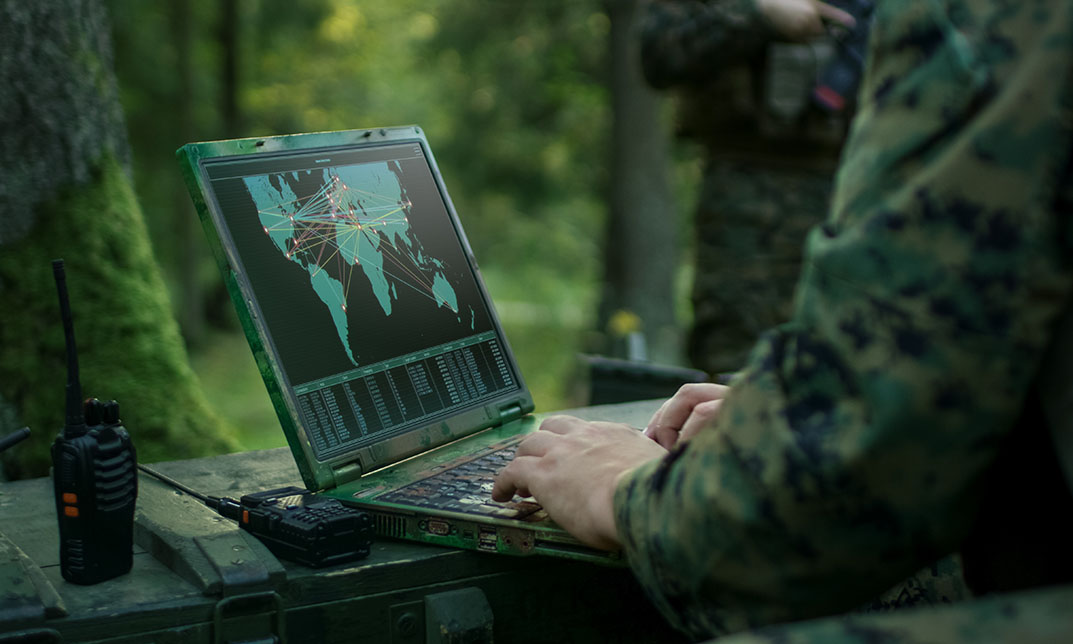
Overview Urban planning, environmental management, disaster management and many other fields require professionals with a good understanding of geospatial technology. If you are an aspiring professional in one of these industries, our Geospatial Technology Training is perfect for you. In this course, you will receive an overall understanding of geospatial technology. You will learn about the fundamentals of Geographic Information Systems from the comprehensive modules. The course will cover detailed lessons on spatial data management, spatial analysis techniques, and remote sensing. In addition, you will learn the principles of web-based mapping and visualisation. When you complete the course, you will receive a recognised certificate of achievement. So, if you want to pursue a promising career in the relevant fields enrol now! Course Preview Learning Outcomes Understand the basics of Geographic Information Systems Learn the key aspects of spatial data management Get introduced to spatial analysis techniques Enhance your knowledge about remote sensing Grasp the principles of web-based mapping and visualisation Develop a solid foundation in geospatial automation and programming Why Take This Course From John Academy? Affordable, well-structured and high-quality e-learning study materials Engaging tutorial videos, materials from the industry-leading experts Opportunity to study in a user-friendly, advanced online learning platform Efficient exam systems for the assessment and instant result Earn UK & internationally recognised accredited qualification Easily access the course content on mobile, tablet, or desktop from anywhere, anytime Excellent career advancement opportunities Get 24/7 student support via email. What Skills Will You Learn from This Course? Spatial data management Spatial analysis Remote sensing Web-based Mapping Who Should Take This Geospatial Technology Training? Whether you're an existing practitioner or an aspiring professional, this course is an ideal training opportunity. It will elevate your expertise and boost your CV with key skills and a recognised qualification attesting to your knowledge. Are There Any Entry Requirements? This Geospatial Technology Training course is available to all learners of all academic backgrounds. But learners should be aged 16 or over to undertake the qualification. And a good understanding of the English language, numeracy, and ICT will be helpful. Certificate of Achievement After completing this course successfully, you will be able to obtain an Accredited Certificate of Achievement. Certificates & Transcripts can be obtained either in Hardcopy at £14.99 or in PDF format at £11.99. Career Pathâ This exclusive Geospatial Technology Training will equip you with effective skills and abilities and help you explore career paths such as GIS Analyst Cartographer Remote Sensing Specialist Geospatial Consultant Module 01: Introduction to Geospatial Technology Introduction to Geospatial Technology 00:18:00 Module 02: Geographic Information Systems (GIS) Basics Geographic Information Systems (GIS) Basics 00:22:00 Module 03: Spatial Data Management Spatial Data Management 00:20:00 Module 04: Spatial Analysis Techniques Spatial Analysis Techniques 00:16:00 Module 05: Remote Sensing and Imagery Remote Sensing and Imagery 00:19:00 Module 06: Web-Based Mapping and Visualisation Web-Based Mapping and Visualisation 00:19:00 Module 07: Geospatial Programming and Automation Geospatial Programming and Automation 00:17:00 Module 08: GIS Applications and Real-World Projects GIS Applications and Real-World Projects 00:15:00 Certificate and Transcript Order Your Certificates and Transcripts 00:00:00

Embark on a thrilling archaeological journey with our Masterclass: Unearthing the Secrets of the Past. Learn fieldwork techniques, excavation methods, and artefact analysis. Dive into the world of modern technology in archaeology. Join us to unlock the mysteries of ancient civilizations and gain hands-on skills for uncovering and preserving our shared human history.
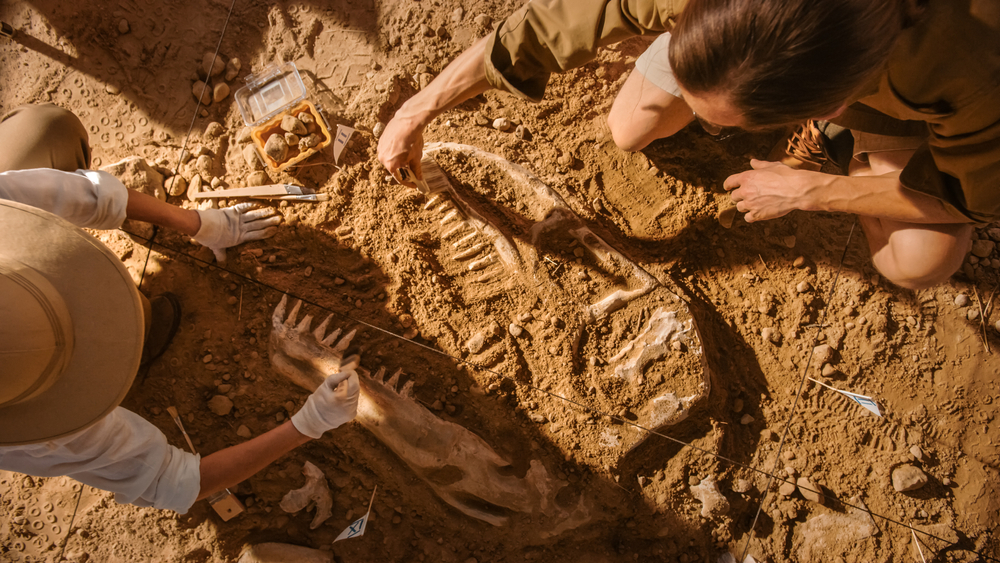
Explore the fascinating world of archaeology with our hands-on training course in Fieldwork Techniques. From preliminary research to cutting-edge technology applications, dive into excavation, artefact analysis, conservation, and specialized site work. Gain practical skills in field recording and documentation, while incorporating modern technology like GIS and 3D modeling. Unearth a comprehensive understanding of archaeological methods for a fulfilling career or enrich your expertise. Join us for a transformative journey where history comes to life through experiential learning.

Explore the dynamic world beneath the Earth's surface with our Structural Geology course. Delve into rock deformation mechanisms, folds, faults, and tectonic structures. Gain hands-on experience with advanced techniques and applications in geological mapping. Uncover the secrets of the Earth's crust and apply your knowledge to real-world scenarios. Enroll now for a comprehensive journey through the principles and applications of Structural Geology.

Dive into the captivating world of marine archaeology with our course on Basic Exploration Techniques. Explore sustainable practices, master essential tools, uncover the secrets of prehistoric underwater civilizations, navigate legal and ethical considerations, and embrace cutting-edge technologies. Join us to chart the depths, preserve cultural heritage responsibly, and embark on a journey that spans from the ancient seas to the forefront of underwater exploration. Enroll now for an immersive experience in Marine Archaeology and be part of unraveling history beneath the waves.