- Professional Development
- Medicine & Nursing
- Arts & Crafts
- Health & Wellbeing
- Personal Development
UX Design Process Simplified from User Research to Usability
By Packt
UX Process for Beginners from User Interviews to Personas, User stories, Information architecture to Usability testing

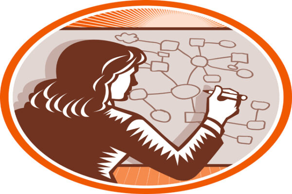
Description Mind Mapping Diploma A mind map is a diagram or graphic representation visualizing connections between various ideas, concepts or pieces of information. A mind map uses a non-linear graphical layout to represent various tasks, items or concepts which is connected and arranged around a central subject or concept. Mind mapping unlocks the full potential of the brain by employing word, image, number, logic, rhythm, color and spatial awareness to create a powerful graphic technique that will enhance learning and promote clearer thinking. Although the term mind mapping is familiar to many, the technique hasn't been fully utilized by people. Mind mapping has been proven to offer great help in various aspects of our life especially while making notes and representing a complex piece of information. Mind mapping is essential while making notes from a book, taking notes during meetings and preparing for talks and lectures. All this can be created just using pen and paper. Mind mapping software are also available to generate maps but without basic understanding of how mind mapping works, it isn't easy to use the software. Mind Mapping Diploma introduces mind mapping as a visualization technique that can be deployed effectively in various spheres of our lives whether it is work or personal. The benefits of visualization techniques over textual representation techniques are clearly summarized in Mind Mapping Diploma. Mind Mapping Diploma reveals why mind mapping works and how it is a brain-friendly technique that allows quick assimilation, effective retention and recalling of information. The process of creating a mind map is discussed step-by-step and in detail in Mind Mapping Diploma. The course of Mind Mapping Diploma also makes a plausible comparison between mind mapping using the traditional pen and paper technique and using a computer software. Along with the art of generating a mind map, Mind Mapping Diploma also throws light into different elements of this outstanding graphic technique and how to put them into effective use. Mind Mapping Diploma does not confine the technique of mind mapping with strict rules and compulsory instructions to follow, it lets you experiment and develop your own individual style of mind mapping. Mind Mapping Diploma covers using mind mapping technique for the most common and frequent needs like note-making for lectures and talks and note-making from talks and meetings. The scope of Mind Mapping technique also includes learning and preparing for examinations through mind mapping. Anyone who completes Mind Mapping Diploma will not only be able to generate effective personalized mind maps but also be able to read textual information through the lens of mind mapping so that it can be easily converted to a mind map within a very short period of time. Mind Mapping Diploma is a course designed for everyone who finds that there is need to better organize the information in and around them to utilize it in the most effective manner possible. What you will learn 1: Introducing Mind Mapping 2: Visualizing Information 3: Generating Mind Maps 4: Why Mind Mapping Works 5: Mind Mapping: Talks and Lectures 6: Handling Text with Mind Mapping 7: Software versus Traditional Mind Mapping 9: Mind Mapping Reading Techniques 10: Learning and Preparing for Exams with Mind Mapping Course Outcomes After completing the course, you will receive a diploma certificate and an academic transcript from Elearn college. Assessment Each unit concludes with a multiple-choice examination. This exercise will help you recall the major aspects covered in the unit and help you ensure that you have not missed anything important in the unit. The results are readily available, which will help you see your mistakes and look at the topic once again. If the result is satisfactory, it is a green light for you to proceed to the next chapter. Accreditation Elearn College is a registered Ed-tech company under the UK Register of Learning( Ref No:10062668). After completing a course, you will be able to download the certificate and the transcript of the course from the website. For the learners who require a hard copy of the certificate and transcript, we will post it for them for an additional charge.

Scala & Spark-Master Big Data with Scala and Spark
By Packt
Scala is doubtless one of the most in-demand skills for data scientists and data engineers. This competitive course will teach you the essential concepts and methodologies of Scala with a lot of practical implementations.

Windows 10 End User
By iStudy UK
The focus of this Windows 10 End User course is to introduce you to the Microsoft Windows 10 operating system and explain the basics of navigating the new Windows 10 operating system for becoming more productive and efficient. You'll know how to log in and learn essential functionality and review new functionality and features in Windows 10, following with review file management and customisation with File Explorer, customise and personalise desktop and other areas of the Windows 10 operating setting. You'll also learn to work with applications and programs including installing, updating, and troubleshooting, and get accustomed with Cortana, learn to use the new Maps, Mail, People, Calendar, and Weather features. Furthermore, you'll learn more about Microsoft Edge, its functionality and new features. What you'll learn Get started by logging in and navigating the Windows 10 environment. Personalize the interface and customize settings. Manage files and folders, and learn about OneDrive. Become familiar with Edge, Microsoft's newest browser, and explore the features. Learn to use Cortana, Maps, Photos, Mail, People, Calendar and Weather. Learn to install applications, set defaults, and manage updating and troubleshooting settings. Requirements Basic familiarity with computers and navigating the Internet. Who this course is for: Students who want to become familiar with the new Windows 10 environment. Introduction Intro- No Animation FREE 00:01:00 Getting Started in Windows 10 Logging In 00:02:00 The Startup Screen 00:04:00 Exploring the Desktop 00:02:00 General Navigation 00:04:00 Introducing the Action Center and Control Panel 00:02:00 Tablet Mode 00:03:00 Launching Applications 00:03:00 Interacting with Windows 00:06:00 Quitting Applications 00:04:00 Pinning Applications 00:03:00 Customizing the Start Menu 00:03:00 Customizing the Task Bar 00:02:00 Multitasking to Switch Between Multiple Applications 00:03:00 Managing several deskstops Using Task View 00:03:00 Using Cortana 00:03:00 Cortana Setup 00:03:00 File Management Overview of the drive and folder structure 00:04:00 Using Navigation Pane, Details Pane, Preview Pane 00:04:00 Menus and Ribbons 00:03:00 Viewing and Editing File Properties_Revised 00:04:00 Creating Files 00:06:00 Selecting, Moving, and Copying Files_Revised 00:06:00 Renaming Files and Folders 00:03:00 Deleting and Restoring from the Recycle Bin 00:05:00 Create and use shortcuts_Revised 00:05:00 Zip and Unzip 00:07:00 Changing the Sort and Group by 00:06:00 Add Columns to the Explorer View 00:04:00 Creating and Using a Library 00:07:00 Adding Files to a Library 00:09:00 Pin Frequent Places Customizing File Explorer 00:04:00 Configuring Files and Explore Options 00:03:00 Logging In or Setting Up OneDrive 00:02:00 Storing and acessing files on OneDrive 00:03:00 Sharing Files Through OneDrive 00:05:00 Syncing Files on OneDrive 00:03:00 Using Edge Browsing the Web 00:02:00 Customize Top Sites 00:02:00 Using Tabs 00:03:00 Organize Favorites with Folders 00:02:00 Using the Reading List and Reading View 00:03:00 Using Saving Sharing Web Notes 00:04:00 Downloading Files 00:02:00 Viewing and Clearing History 00:02:00 Using Windows Apps Maps- Search Get Directions Choose View 00:04:00 Maps- Search Tips and Favorites 00:04:00 Maps- More Search Tips and Map Settings 00:03:00 Photos - Browsing_REVISED 00:05:00 Photos - Using Editing Tools_REVISED 00:04:00 Mail- Add Accounts 00:05:00 Mail- Personalizing and Configuring 00:04:00 Mail Send a Message 00:04:00 People Search Link and Share Contacts 00:04:00 People Search Link and Share Contacts 00:04:00 Calendar Configuring and Viewing 00:04:00 Calendar Changing Views Creating and Editing Events 00:07:00 Weather Add Favorite Locations and Viewing the Weather 00:04:00 Weather- Viewing Historical Data nad Weather Maps 00:03:00 Customizing Windows 10 Managing Accounts and Sign In Options 00:03:00 Background Settings 00:04:00 Lock Screen 00:02:00 Change Windows Themes 00:02:00 Personalize Start 00:04:00 Change Screen Resolution 00:02:00 Adjust Audio Settings 00:02:00 Manage Sleep and Screen Saver 00:04:00 Change Default Storage Locations 00:02:00 Managing Devices 00:03:00 Change Type Settings 00:01:00 Adjust Mouse and Touchpad Settings 00:03:00 Adjust Autoplay Settings 00:02:00 Installing, Updating, and Troubleshooting Installing Applications from the Windows Store 00:03:00 Installing Applications From the Web 00:03:00 Setting Application Defaults 00:03:00 Setting App Privacy and Permissions 00:02:00 Uninstalling Applications 00:01:00 Configure Windows Defender and Windows Updates 00:02:00 Access Task Manage 00:02:00 Accessing the Action Center to View Messages 00:02:00 Backing Up and Restoring Files and Using Recover to Reset Your PC 00:07:00 Conclusion Course Recap 00:01:00

24-Hour Knowledge Knockdown! Prices Reduced Like Never Before Imagine you are soaring high above the earth, observing the world from a bird's-eye view. Remote Sensing in ArcGIS bundle could be your ticket to experiencing the world in a way you never have before. In the UK alone, the geospatial industry contributes over £11 billion to the economy. With 11 courses, this Remote Sensing in ArcGIS bundle is a one-stop shop for all your GIS and remote sensing needs. The bundle's crown jewel is the Remote Sensing in ArcGIS course, which is QLS-endorsed and comes with a hardcopy certificate. With courses covering everything from QGIS Cartography to Business Intelligence and Data Mining Diploma, this bundle is a comprehensive guide to all things remote sensing. You'll learn how to create smart maps in Python, perform spatial analysis in ArcGIS, and even use web scraping to map dam levels. The possibilities are endless! This Remote Sensing in ArcGIS Bundle Package includes: Course 01: Award in Remote Sensing in ArcGIS at QLS Level 2 10 Premium Additional CPD QS Accredited Courses - Course 01: QGIS Cartography Course 02: Spatial Data Visualization and Machine Learning in Python Level 4 Course 03: Create Smart Maps in Python and Leaflet Level 3 Course 04: Spatial Analysis in ArcGIS Course 05: ArcGIS for Hydrology Course 06: Web Scraping and Mapping Dam Levels in Python and Leaflet Level 4 Course 07: Learn to Use Python for Spatial Analysis in ArcGIS Course 08: The Basics of ArcGIS for Hydrology Course 09: Python Data Science Course 10: Business Intelligence and Data Mining Diploma Don't miss this opportunity to expand your knowledge and skills in remote sensing. Enrol in the Remote Sensing in ArcGIS bundle today and take your first step towards exploring the world from a whole new perspective. Why Choose Us? Get a free QLS endorsed Certificate upon completion of Remote Sensing in ArcGIS Get a free student ID card with Remote Sensing in ArcGIS Training The Remote Sensing in ArcGIS is affordable and simple to understand This course is entirely online, interactive lesson with voiceover audio Lifetime access to the Remote Sensing in ArcGIS course materials The Remote Sensing in ArcGIS comes with 24/7 tutor support After taking this Remote Sensing in ArcGIS bundle courses, you will be able to learn: Gain expertise in remote sensing and GIS technologies. Understand the fundamentals of spatial data analysis and visualisation. Learn to create maps using Python and Leaflet. Explore machine learning techniques for spatial data analysis. Get hands-on experience in ArcGIS for hydrology. Understand web scraping and mapping using Python and Leaflet. Develop proficiency in data mining, business intelligence, and Python data science. ***Curriculum breakdown *** Module 01: Remote sensing, satellite images, spectral bands introduction Module 02: Layers stacking satellite images Module 03: Georeferencing satellite images Module 04: Introduction to geoprocessing raster tools Module 05: Raster Analysis Functions Module 06: Georeferencing toposheet Module 07: Site suitability using weighted overlay analysis - part 1 Module 08: Site suitability using weighted overlay analysis - part 2 Module 09: Watershed Delineation from DEM Module 10: Unsupervised classification Assessment Process You have to complete the assignment questions given at the end of the course and score a minimum of 60% to pass each exam. You will be entitled to claim a certificate endorsed by the Quality Licence Scheme after you successfully pass the Award in Remote Sensing in ArcGIS at QLS Level 2 exams. CPD 180 CPD hours / points Accredited by CPD Quality Standards Who is this course for? This bundle is ideal for: Students seeking mastery in this field Professionals seeking to enhance their skills Anyone who is passionate about this topic Requirements This Remote Sensing in ArcGIS doesn't require prior experience and is suitable for diverse learners. Career path This Remote Sensing in ArcGIS bundle will be beneficial for anyone looking to pursue a career as: GIS Analyst Remote Sensing Specialist Spatial Data Scientist Geospatial Project Manager GIS Consultant GIS Team Leader Certificates Award in Remote Sensing in ArcGIS at QLS Level 2 Hard copy certificate - Included CPD QS Accredited Certificate Hard copy certificate - Included International students are subject to a £10 delivery fee for their orders, based on their location. CPD QS Accredited PDF Certificate Digital certificate - Included

Person Centred Planning in Action
By Inclusive Solutions
An hour long educational and inspirational introduction to person centred planning in action

Business Intelligence with Microsoft Power BI - with Material
By Packt
This course will take you through the key tools of Power BI. You will learn how to use them to clean and visualize data and create impressive reports and dashboards with ease.


