- Professional Development
- Medicine & Nursing
- Arts & Crafts
- Health & Wellbeing
- Personal Development
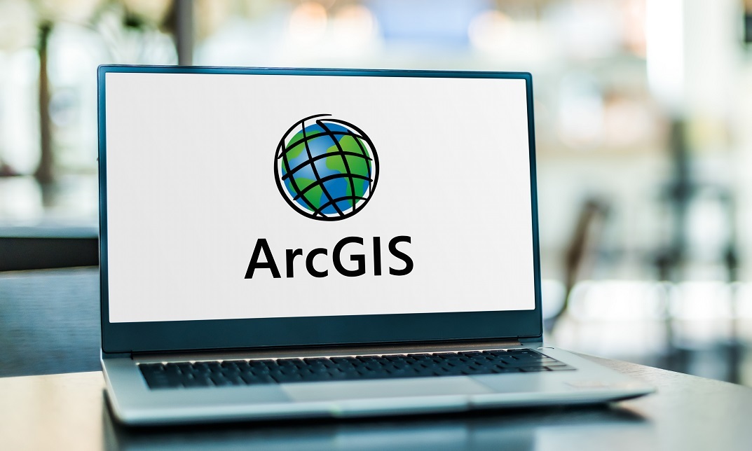
Register on the Python for Spatial Analysis in ArcGIS today and build the experience, skills and knowledge you need to enhance your professional development and work towards your dream job. Study this course through online learning and take the first steps towards a long-term career. The course consists of a number of easy to digest, in-depth modules, designed to provide you with a detailed, expert level of knowledge. Learn through a mixture of instructional video lessons and online study materials. Receive online tutor support as you study the course, to ensure you are supported every step of the way. Get an e-certificate as proof of your course completion. The Python for Spatial Analysis in ArcGIS is incredibly great value and allows you to study at your own pace. Access the course modules from any internet-enabled device, including computers, tablet, and smartphones. The course is designed to increase your employability and equip you with everything you need to be a success. Enrol on the now and start learning instantly! What You Get With The Python for Spatial Analysis in ArcGIS Receive a e-certificate upon successful completion of the course Get taught by experienced, professional instructors Study at a time and pace that suits your learning style Get instant feedback on assessments 24/7 help and advice via email or live chat Get full tutor support on weekdays (Monday to Friday) Course Design The course is delivered through our online learning platform, accessible through any internet-connected device. There are no formal deadlines or teaching schedules, meaning you are free to study the course at your own pace. You are taught through a combination of Video lessons Online study materials Certification Upon successful completion of the course, you will be able to obtain your course completion e-certificate free of cost. Print copy by post is also available at an additional cost of £9.99 and PDF Certificate at £4.99. Who Is This Course For: The course is ideal for those who already work in this sector or are an aspiring professional. This course is designed to enhance your expertise and boost your CV. Learn key skills and gain a professional qualification to prove your newly-acquired knowledge. Requirements: The online training is open to all students and has no formal entry requirements. To study the Python for Spatial Analysis in ArcGIS, all your need is a passion for learning, a good understanding of English, numeracy, and IT skills. You must also be over the age of 16. Course Content Python for Spatial Analysis in ArcGIS Module 01: Introduction of batch processing 00:15:00 Module 02: Link a series of processes to one 00:12:00 Module 03: Animation of feature data 1 00:11:00 Module 04: Animation of feature data 2 00:13:00 Module 05: Animation of raster data 1 00:13:00 Module 06: Animation of raster data 2 00:10:00 Module 07: Collect data and Batch processing 00:10:00 Module 08: Hydrological processing with python script 00:11:00 Module 09: Map Algebra and Math 1 00:10:00 Module 10: Map Algebra and Math 2 00:10:00 Module 11: Display XY, Select and Export 00:10:00 Module 12: Surface and Interpolation 00:10:00 Assignment Assignment - Python for Spatial Analysis in ArcGIS 00:00:00 Frequently Asked Questions Are there any prerequisites for taking the course? There are no specific prerequisites for this course, nor are there any formal entry requirements. All you need is an internet connection, a good understanding of English and a passion for learning for this course. Can I access the course at any time, or is there a set schedule? You have the flexibility to access the course at any time that suits your schedule. Our courses are self-paced, allowing you to study at your own pace and convenience. How long will I have access to the course? For this course, you will have access to the course materials for 1 year only. This means you can review the content as often as you like within the year, even after you've completed the course. However, if you buy Lifetime Access for the course, you will be able to access the course for a lifetime. Is there a certificate of completion provided after completing the course? Yes, upon successfully completing the course, you will receive a certificate of completion. This certificate can be a valuable addition to your professional portfolio and can be shared on your various social networks. Can I switch courses or get a refund if I'm not satisfied with the course? We want you to have a positive learning experience. If you're not satisfied with the course, you can request a course transfer or refund within 14 days of the initial purchase. How do I track my progress in the course? Our platform provides tracking tools and progress indicators for each course. You can monitor your progress, completed lessons, and assessments through your learner dashboard for the course. What if I have technical issues or difficulties with the course? If you encounter technical issues or content-related difficulties with the course, our support team is available to assist you. You can reach out to them for prompt resolution.

Overview This comprehensive course on Introduction to GIS and ArcGIS will deepen your understanding on this topic. After successful completion of this course you can acquire the required skills in this sector. This Introduction to GIS and ArcGIS comes with accredited certification from CPD, which will enhance your CV and make you worthy in the job market. So enrol in this course today to fast track your career ladder. How will I get my certificate? You may have to take a quiz or a written test online during or after the course. After successfully completing the course, you will be eligible for the certificate. Who is This course for? There is no experience or previous qualifications required for enrolment on this Introduction to GIS and ArcGIS. It is available to all students, of all academic backgrounds. Requirements Our Introduction to GIS and ArcGIS is fully compatible with PC's, Mac's, Laptop, Tablet and Smartphone devices. This course has been designed to be fully compatible with tablets and smartphones so you can access your course on Wi-Fi, 3G or 4G. There is no time limit for completing this course, it can be studied in your own time at your own pace. Career Path Learning this new skill will help you to advance in your career. It will diversify your job options and help you develop new techniques to keep up with the fast-changing world. This skillset will help you to- Open doors of opportunities Increase your adaptability Keep you relevant Boost confidence And much more! Course Curriculum 1 sections • 10 lectures • 01:54:00 total length •What is GIS?: 00:09:00 •Data Models: 00:13:00 •Managing Data: 00:12:00 •Navigating the ArcMap Software: 00:13:00 •Working with Vector Data Layers: 00:10:00 •Analysis Tools: 00:11:00 •Symbolizing Data I: 00:11:00 •Symbolizing Data II: 00:10:00 •Creating Map Layouts I: 00:10:00 •Creating Map Layouts II: 00:15:00
Register on the Introduction to GIS and ArcGIS today and build the experience, skills and knowledge you need to enhance your expert development and work towards your dream job. Study this course through online learning and take the first steps towards a long-term career. The course consists of a number of easy to digest, in-depth modules, designed to provide you with a detailed, expert level of knowledge. Learn through a mixture of instructional video lessons and online study materials. Receive online tutor support as you study the course, to ensure you are supported every step of the way. Get an e-certificate as proof of your course completion. The Introduction to GIS and ArcGIS is incredibly great value and allows you to study at your own pace. Access the course modules from any internet-enabled device, including computers, tablet, and smartphones. The course is designed to increase your employability and equip you with everything you need to be a success. Enrol on the now and start learning instantly! What You Get With The Introduction to GIS and ArcGIS Receive a e-certificate upon successful completion of the course Get taught by experienced, expert instructors Study at a time and pace that suits your learning style Get instant feedback on assessments 24/7 help and advice via email or live chat Get full tutor support on weekdays (Monday to Friday) Course Design The course is delivered through our online learning platform, accessible through any internet-connected device. There are no formal deadlines or teaching schedules, meaning you are free to study the course at your own pace. You are taught through a combination of Video lessons Online study materials Certificate of Achievement Endorsed Certificate of Achievement from the Quality Licence Scheme Once the course has been completed and the assessment has been passed, all students are entitled to receive an endorsed certificate. This will provide proof that you have completed your training objectives, and each endorsed certificate can be ordered and delivered to your address for only £59. Please note that overseas students may be charged an additional £10 for postage. CPD Certificate of Achievement from Janets Upon successful completion of the course, you will be able to obtain your course completion e-certificate free of cost. Print copy by post is also available at an additional cost of £9.99 and PDF Certificate at £4.99. Endorsement This course and/or training programme has been endorsed by the Quality Licence Scheme for its high-quality, non-regulated provision and training programmes. This course and/or training programme is not regulated by Ofqual and is not an accredited qualification. Your training provider will be able to advise you on any further recognition, for example progression routes into further and/or higher education. For further information please visit the Learner FAQs on the Quality Licence Scheme website. Method of Assessment In order to ensure the Quality Licensing scheme endorsed and CPD acknowledged certificate, learners need to score at least 60% pass marks on the assessment process. After submitting assignments, our expert tutors will evaluate the assignments and give feedback based on the performance. After passing the assessment, one can apply for a certificate. Who Is This Course For: The course is ideal for those who already work in this sector or are an aspiring expert. This course is designed to enhance your expertise and boost your CV. Learn key skills and gain an expert lesson to prove your newly-acquired knowledge. Requirements: The online training is open to all students and has no formal entry requirements. To study the Introduction to GIS and ArcGIS, all your need is a passion for learning, a good understanding of English, numeracy, and IT skills. You must also be over the age of 16. Course Content Introduction to GIS and ArcGIS What is GIS? 00:09:00 Data Models 00:13:00 Managing Data 00:12:00 Navigating the ArcMap Software 00:13:00 Working with Vector Data Layers 00:10:00 Analysis Tools 00:11:00 Symbolizing Data I 00:11:00 Symbolizing Data II 00:10:00 Creating Map Layouts I 00:10:00 Creating Map Layouts II 00:15:00 Order Your Certificate Order your Certificate QLS 00:00:00 Frequently Asked Questions Are there any prerequisites for taking the course? There are no specific prerequisites for this course, nor are there any formal entry requirements. All you need is an internet connection, a good understanding of English and a passion for learning for this course. Can I access the course at any time, or is there a set schedule? You have the flexibility to access the course at any time that suits your schedule. Our courses are self-paced, allowing you to study at your own pace and convenience. How long will I have access to the course? For this course, you will have access to the course materials for 1 year only. This means you can review the content as often as you like within the year, even after you've completed the course. However, if you buy Lifetime Access for the course, you will be able to access the course for a lifetime. Is there a certificate of completion provided after completing the course? Yes, upon successfully completing the course, you will receive a certificate of completion. This certificate can be a valuable addition to your professional portfolio and can be shared on your various social networks. Can I switch courses or get a refund if I'm not satisfied with the course? We want you to have a positive learning experience. If you're not satisfied with the course, you can request a course transfer or refund within 14 days of the initial purchase. How do I track my progress in the course? Our platform provides tracking tools and progress indicators for each course. You can monitor your progress, completed lessons, and assessments through your learner dashboard for the course. What if I have technical issues or difficulties with the course? If you encounter technical issues or content-related difficulties with the course, our support team is available to assist you. You can reach out to them for prompt resolution.

Overview This comprehensive course on Learn to Use Python for Spatial Analysis in ArcGIS will deepen your understanding on this topic. After successful completion of this course you can acquire the required skills in this sector. This Learn to Use Python for Spatial Analysis in ArcGIS comes with accredited certification, which will enhance your CV and make you worthy in the job market. So enrol in this course today to fast track your career ladder. How will I get my certificate? You may have to take a quiz or a written test online during or after the course. After successfully completing the course, you will be eligible for the certificate. Who is This course for? There is no experience or previous qualifications required for enrolment on this Learn to Use Python for Spatial Analysis in ArcGIS. It is available to all students, of all academic backgrounds. Requirements Our Learn to Use Python for Spatial Analysis in ArcGIS is fully compatible with PC's, Mac's, Laptop, Tablet and Smartphone devices. This course has been designed to be fully compatible with tablets and smartphones so you can access your course on Wi-Fi, 3G or 4G. There is no time limit for completing this course, it can be studied in your own time at your own pace. Career Path Having these various qualifications will increase the value in your CV and open you up to multiple sectors such as Business & Management, Admin, Accountancy & Finance, Secretarial & PA, Teaching & Mentoring etc. Course Curriculum 1 sections • 12 lectures • 02:15:00 total length •Module 01: Introduction of batch processing: 00:15:00 •Module 02: Link a series of processes to one: 00:12:00 •Module 03: Animation of feature data 1: 00:11:00 •Module 04: Animation of feature data 2: 00:13:00 •Module 05: Animation of raster data 1: 00:13:00 •Module 06: Animation of raster data 2: 00:10:00 •Module 07: Collect data and Batch processing: 00:10:00 •Module 08: Hydrological processing with python script: 00:11:00 •Module 09: Map Algebra and Math 1: 00:10:00 •Module 10: Map Algebra and Math 2: 00:10:00 •Module 11: Display XY, Select and Export: 00:10:00 •Module 12: Surface and Interpolation: 00:10:00

GIS: Geographic Information System-(30 in 1) CPD Accredited Courses!
By Compliance Central
Feeling Stuck in Your Career? The GIS: Geographic Information System-(30 in 1) CPD Accredited Courses! Bundle is Your Skill-Building Solution. This exceptional collection of 30 premium courses is designed to encourage growth and improve your career opportunities. Suited to meet different interests and goals, the GIS: Geographic Information System bundle provides an engaging learning experience, helping you learn skills across various disciplines. With GIS: Geographic Information System-(30 in 1) CPD Accredited Courses! Bundle, you'll have a personalised journey that aligns with your career goals and interests. This comprehensive package helps you confidently tackle new challenges, whether entering a new field or enhancing your existing knowledge. The GIS: Geographic Information System bundle is your gateway to expanding your career options, increasing job demand, and enhancing your skill set. By enrolling in this bundle, you'll receive complimentary PDF certificates for all courses, adding value to your resume at no extra cost. Develop key skills and achieve important progress in your career and personal development. Start your journey today and experience the transformative impact of the GIS: Geographic Information System-(30 in 1) CPD Accredited Courses! bundle on your job life and career growth! This GIS: Geographic Information System-(30 in 1) CPD Accredited Courses! Bundle Comprises the Following CPD Accredited Courses: Course 01: Geology Course 02: Introduction to GIS and ArcGIS Course 03: Intensive Training on QGIS for Beginners Course 04: The Basics of ArcGIS for Hydrology Course 05: Remote Sensing in ArcGIS Course 06: Spatial Analysis in ArcGIS Course 07: Python for Spatial Analysis in ArcGIS Course 08: Watershed delineation in ArcGIS Pro and Map Display in ArcGIS Course 09: QGIS Cartography Course 10: Archaeology & Surveying Course 11: Meteorology Course 12: Geospatial Technology Course 13: Develop Smart Maps with Python and Leaflet - Windows Version Course 14: Web GIS Application Development with C# ASP.NET CORE MVC and Leaflet Course 15: U&P AI - Natural Language Processing (NLP) with Python Course 16: Deep Learning Projects - Handwritten Digit Recognition Using Neural Network Course 17: Environmental Engineering Course 18: Environmental Impact Assessment Course 19: Environmental Analyst Course 20: Agricultural Science Course 21: Renewable Energy Course 22: Career Development Plan Fundamentals Course 23: CV Writing and Job Searching Course 24: Learn to Level Up Your Leadership Course 25: Networking Skills for Personal Success Course 26: Ace Your Presentations: Public Speaking Masterclass Course 27: Learn to Make a Fresh Start in Your Life Course 28: Motivation - Motivating Yourself & Others Course 29: Excel: Top 50 Microsoft Excel Formulas in 50 Minutes! Course 30: Decision Making and Critical Thinking What will make you stand out? Upon completion of this online GIS: Geographic Information System-(30 in 1) CPD Accredited Courses! Bundle, you will gain the following: CPD QS Accredited Proficiency with this GIS: Geographic Information System Bundle After successfully completing the GIS: Geographic Information System bundle, you will receive a FREE PDF Certificate from REED as evidence of your newly acquired abilities. Lifetime access to the whole collection of learning materials of this GIS: Geographic Information System Bundle The online test with immediate results You can study and complete the GIS: Geographic Information System bundle at your own pace. Study for the GIS: Geographic Information System bundle using any internet-connected device, such as a computer, tablet, or mobile device. The GIS: Geographic Information System-(30 in 1) CPD Accredited Courses! bundle is a premier learning resource, with each course module holding respected CPD accreditation, symbolising exceptional quality. The content is packed with knowledge and is regularly updated to ensure it remains relevant. This bundle offers not just education but a constantly improving learning experience designed to enrich both your personal and professional development. Advance the future of learning with the GIS: Geographic Information System bundle, a comprehensive, complete collection of 30 courses. Each course in the GIS: Geographic Information System bundle has been handpicked by our experts to provide a broad range of learning opportunities. Together, these modules form an important and well-rounded learning experience. Our mission is to deliver high-quality, accessible education for everyone. Whether you are starting your career, switching industries, or enhancing your professional skills, the GIS: Geographic Information System bundle offers the flexibility and convenience to learn at your own pace. Make the GIS: Geographic Information System package your trusted partner in your lifelong learning journey. CPD 300 CPD hours / points Accredited by CPD Quality Standards Who is this course for? The GIS: Geographic Information System-(30 in 1) CPD Accredited Courses! is perfect for: Expand your knowledge and skillset for a fulfilling career with the GIS: Geographic Information System bundle. Become a more valuable professional by earning CPD certification and mastering in-demand skills with the GIS: Geographic Information System bundle. Discover your passion or explore new career options with the diverse learning opportunities in the GIS: Geographic Information System bundle. Learn on your schedule, in the comfort of your home - the GIS: Geographic Information System bundle offers ultimate flexibility for busy individuals. Requirements You are warmly invited to register for this bundle. Please be aware that no formal entry requirements or qualifications are necessary. This curriculum has been crafted to be open to everyone, regardless of previous experience or educational attainment. Career path Gain a wide range of skills across various fields, improve your problem-solving capabilities, and keep current with industry trends. Perfect for those aiming for career advancement, exploring a new professional direction, or pursuing personal growth. Begin your journey with the GIS: Geographic Information System bundle. Certificates CPD Certificates Digital certificate - Included
Sale Ends Today!! Geotechnical Engineering Admission Gifts FREE PDF & Hard Copy Certificate| PDF Transcripts| FREE Student ID| Assessment| Lifetime Access| Enrolment Letter Do you ever wonder what lies beneath the towering skyscrapers or the vast network of roads you traverse every day? Ground instability in the UK costs over £3 billion annually, while the construction industry contributes over £112 billion to the economy and employs 2.9 million people, highlighting the crucial role of Geotechnical Engineering in ensuring safe and sustainable infrastructure. This Geotechnical Engineering bundle delves into the fascinating world of Geotechnical Engineering, equipping you with the knowledge and skills to assess, analyse, and manage the very foundation of our infrastructure. With our Geotechnical Engineering exclusive bundle, you will get a PDF Certificate, PDF Transcript and Digital Student ID Card (worth £50) Absolutely FREE. Courses are Included in This Geotechnical Engineering Bundle: Course 01: Advanced Diploma in Geology at QLS Level 7 Course 02: Structural Geology: Geological Landscape of the Earth Course 03: Geospatial Technology: GIS and Remote Sensing Course 04 The Basics of ArcGIS for Hydrology Course 05: Spatial Analysis in ArcGIS Course 06: Remote Sensing in ArcGIS Course 07: QGIS Cartography Course 08: Applied Statistics Course 09: MATLAB Simulink for Electrical Power Engineering Course 10: Autocad Design Course 11: Forensic Anthropology Course 12: Meteorology Course 13: Carbon Literacy Knowledge Course 14: Petrolium Engineering Course 15: Oil and Gas Management Course 16: Diploma in Water Chemistry Course 17: Agricultural Science Course 18: Environment Management Course 19: Environmental Law Course 20: Forestry Course 21: Gemology Course 22: Construction Management Course 23: Land Management Course 24: Building Surveying Course 25: Architectural Studies 5 Amazing Career Courses to Help You Level Up Your Skills: Course 26: Effective Communication Skills Course 27: Delegation Skills Training Course 28: Time Management Course 29: Leadership Skills Training Course 30: Decision Making and Critical Thinking This Geotechnical Engineering bundle covers advanced geology, environmental law, ArcGIS, hydrology, remote sensing, forensic anthropology, meteorology, carbon literacy, land management, environmental health, resource management, oil, gas, water chemistry, agricultural science, and architectural studies, providing a comprehensive understanding of geotechnical engineering, land management, and environmental health. Enhance your career prospects, boost your understanding of Geotechnical Engineering challenges, and contribute to building a stronger, more resilient future. Take the first step and enrol today in our Geotechnical Engineering bundle! Learning Outcomes of Geotechnical Engineering Bundle Master advanced geology principles and their application in construction. Gain proficiency in ArcGIS for effective spatial analysis in geotechnical engineering. Understand remote sensing techniques for environmental assessment. Learn the basics of hydrology and its application in engineering. Acquire knowledge in environmental law and land management. Develop skills in resource management, including oil and gas. Why Choose Our Geotechnical Engineering Bundle ? FREE Geotechnical Engineering certificate accredited Get a free student ID card with Geotechnical Engineering Training Get instant access to this Geotechnical Engineering course. Learn Geotechnical Engineering from anywhere in the world The Geotechnical Engineering is affordable and simple to understand The Geotechnical Engineering is an entirely online, interactive lesson with voiceover audio Lifetime access to the Geotechnical Engineering course materials The Geotechnical Engineering comes with 24/7 tutor support Start your learning journey straight away! The "Geotechnical Engineering Bundle" provides an extensive array of courses that equip learners with cutting-edge skills and knowledge in the field of geotechnical engineering and related disciplines. By diving into advanced Geology and Structural Analyses of the Earth's Landscape, participants will gain a robust understanding of geological processes and structures, enhancing their ability to tackle complex geotechnical challenges. Furthermore, the integration of GIS and Remote Sensing into the curriculum allows for the application of geospatial technologies, optimising Data Analysis and Decision-Making in critical scenarios. This comprehensive bundle also includes specialised training in ArcGIS tools tailored for Hydrology, Spatial Analysis, and Remote Sensing applications. Such skills are invaluable in today's technology-driven work environments, where precision and efficiency in data handling and interpretation are essential. Learners will emerge with the capability to implement these tools effectively, leading to more informed and accurate project outcomes. Moreover, this diploma offers learners the opportunity to acquire skills that are highly valued in the field of Geotechnical Engineering. With this Certification, graduates are better positioned to pursue career advancement and higher responsibilities within the Geotechnical Engineering setting. The skills and knowledge gained from this course will enable learners to make meaningful contributions to Geotechnical Engineering related fields impacting their Geotechnical Engineering experiences and long-term development. Course Curriculum Course 01: Advanced Diploma in Geology at QLS Level 7 Module 01: Basic Introduction Module 02: Tectonics Module 03: Geologic Time Module 04: Geologic Materials Module 05: Volcano Module 06: Earthquake And Earth's Structure (Core) Module 07: The Earth Atmosphere Module 08: Natural Resources Module 09: Earth's Internal Structure Course 02: Structural Geology: Geological Landscape of the Earth Module 01: Introduction Module 02: Solar System Module 03: Geologic Time Module 04: Inside Earth Module 05: Plate Tectonics Module 06: Weathering Module 07: Deserts & Winds Module 08: Minerals Module 09: Sedimentary Rocks Module 10: Metamorphic Rocks Module 11: Igneous Rock Module 12: Deformation Module 13: Volcanoes Module 14: Mass Wasting Module 15: Surface Water Course 03: Geospatial Technology: GIS and Remote Sensing Module 01: Introduction To Geospatial Technology Module 02: Geographic Information Systems (GIS) Basics Module 03: Spatial Data Management Module 04: Spatial Analysis Techniques Module 05: Remote Sensing And Imagery Module 06: Web-Based Mapping And Visualisation Module 07: Geospatial Programming And Automation Module 08: GIS Applications And Real-World Projects =========>>>>> And 27 More Courses <<<<<========= How will I get my Certificate? After successfully completing the course, you will be able to order your Certificates as proof of your achievement. PDF Certificate: Free (Previously it was £12.99*30 = £390) CPD Hard Copy Certificate: Free (For The First Course: Previously it was £29.99) CPD 300 CPD hours / points Accredited by CPD Quality Standards Who is this course for? This Geotechnical Engineering bundle is suitable for everyone. Aspiring geotechnical engineers. GIS specialists. Environmental consultants. Construction project managers. Urban planning professionals. Hydrology and forestry experts. Requirements You will not need any prior background or expertise in this Geotechnical Engineering bundle. Career path This Geotechnical Engineering bundle will allow you to kickstart or take your career in the related sector to the next stage such as: Geotechnical Engineer: $65,000 - $100,000 GIS Analyst: $50,000 - $75,000 Remote Sensing Specialist: $60,000 - $90,000 Environmental Consultant: $50,000 - $80,000 Construction Project Manager: $70,000 - $110,000 Hydrologist: $60,000 - $90,000 Certificates CPD Accredited Digital Certificate Digital certificate - Included CPD Accredited e-Certificate - Free Enrolment Letter - Free Student ID Card - Free CPD Accredited Hard Copy Certificate Hard copy certificate - Included If you are an international student, then you have to pay an additional 10 GBP for each certificate as an international delivery charge.

24 Hour Flash Deal **25-in-1 Geospatial Engineering Mega Bundle** Geospatial Engineering Enrolment Gifts **FREE PDF Certificate**FREE PDF Transcript ** FREE Exam** FREE Student ID ** Lifetime Access **FREE Enrolment Letter ** Take the initial steps toward a successful long-term career by studying the Geospatial Engineering package online with Studyhub through our online learning platform. The Geospatial Engineering bundle can help you improve your CV, wow potential employers, and differentiate yourself from the mass. This Geospatial Engineering course provides complete 360-degree training on Geospatial Engineering. You'll get not one, not two, not three, but twenty-five Geospatial Engineering courses included in this course. Plus Studyhub's signature Forever Access is given as always, meaning these Geospatial Engineering courses are yours for as long as you want them once you enrol in this course This Geospatial Engineering Bundle consists the following career oriented courses: Course 01: Geospatial Technology, Remote Sensing and Web Mapping Course 02: Biogeography, Citizen Science and Global Biodiversity Course 03: Climate Science Explained: Understanding Earth's Climate Course 04: Diploma in Water Chemistry Course 05: Ecological Restoration: Principles and Practices Course 06: Environmental Engineering Course 07: Environmental Impact Assessment: Evaluating Sustainability Course 08: Environmental Management Course 09: Environmental Science and Climate Change Dynamics Course 10: Exploring Sustainable Ecotourism Practices Around the World Course 11: Forestry Course 12: Land Management Course Course 13: Marine Biology Courses Online Course 14: QGIS Cartography Course 15: Remote Sensing in ArcGIS Course 16: Spatial Analysis in ArcGIS Course 17: Sustainable Agriculture in the UK: Farming for the Future Course 18: Sustainable Agriculture: From Farm to Fork Course 19: Urban Farming and Gardening Course 20: Urban Gardening and Sustainable Cities Course 21: Wildlife Rescue and Rehabilitation Course 22: Water Treatment Course 23: Weeds Identification and Control: Maintaining Green Spaces Course 24: The Basics of ArcGIS for Hydrology Course 25: Carbon Literacy Project Certifications The Geospatial Engineering course has been prepared by focusing largely on Geospatial Engineering career readiness. It has been designed by our Geospatial Engineering specialists in a manner that you will be likely to find yourself head and shoulders above the others. For better learning, one to one assistance will also be provided if it's required by any learners. The Geospatial Engineering Bundle is one of the most prestigious training offered at StudyHub and is highly valued by employers for good reason. This Geospatial Engineering bundle course has been created with twenty-five premium courses to provide our learners with the best learning experience possible to increase their understanding of their chosen field. This Geospatial Engineering Course, like every one of Study Hub's courses, is meticulously developed and well researched. Every one of the topics is divided into Geospatial Engineering Elementary modules, allowing our students to grasp each lesson quickly. The Geospatial Engineering course is self-paced and can be taken from the comfort of your home, office, or on the go! With our Student ID card you will get discounts on things like music, food, travel and clothes etc. In this exclusive Geospatial Engineering bundle, you really hit the jackpot. Here's what you get: Step by step Geospatial Engineering lessons One to one assistance from Geospatial Engineeringprofessionals if you need it Innovative exams to test your knowledge after the Geospatial Engineeringcourse 24/7 customer support should you encounter any hiccups Top-class learning portal Unlimited lifetime access to all twenty-five Geospatial Engineering courses Digital Certificate, Transcript and student ID are all included in the price PDF certificate immediately after passing Original copies of your Geospatial Engineering certificate and transcript on the next working day Easily learn the Geospatial Engineering skills and knowledge you want from the comfort of your home CPD 250 CPD hours / points Accredited by CPD Quality Standards Who is this course for? This Geospatial Engineering training is suitable for - Students Recent graduates Job Seekers Individuals who are already employed in the relevant sectors and wish to enhance their knowledge and expertise in Geospatial Engineering Requirements To participate in this Geospatial Engineering course, all you need is - A smart device A secure internet connection And a keen interest in Geospatial Engineering Career path You will be able to kickstart your Geospatial Engineering career because this course includes various courses as a bonus. This Geospatial Engineering is an excellent opportunity for you to learn multiple skills from the convenience of your own home and explore Geospatial Engineering career opportunities. Certificates CPD Accredited Certificate Digital certificate - Included CPD Accredited e-Certificate - Free CPD Accredited Hardcopy Certificate - Free Enrolment Letter - Free Student ID Card - Free

24 Hour Flash Deal **25-in-1 GIS Specialist Diploma Mega Bundle** GIS Specialist Diploma Enrolment Gifts **FREE PDF Certificate**FREE PDF Transcript ** FREE Exam** FREE Student ID ** Lifetime Access **FREE Enrolment Letter ** Take the initial steps toward a successful long-term career by studying the GIS Specialist Diploma package online with Studyhub through our online learning platform. The GIS Specialist Diploma bundle can help you improve your CV, wow potential employers, and differentiate yourself from the mass. This GIS Specialist Diploma course provides complete 360-degree training on GIS Specialist Diploma. You'll get not one, not two, not three, but twenty-five GIS Specialist Diploma courses included in this course. Plus Studyhub's signature Forever Access is given as always, meaning these GIS Specialist Diploma courses are yours for as long as you want them once you enrol in this course This GIS Specialist Diploma Bundle consists the following career oriented courses: Course 01: Spatial Analysis in ArcGIS Course 02: Geospatial Technology, Remote Sensing and Web Mapping Course 03: The Basics of ArcGIS for Hydrology Course 04: Remote Sensing in ArcGIS Course 05: QGIS Cartography Course 06: Urban Planning Course Course 07: Structural Geology, Tectonics & Rock Mechanics Course 08: Biogeography, Citizen Science and Global Biodiversity Course 09: Climate Science Explained: Understanding Earth's Climate Course 10: Ecological Restoration: Principles and Practices Course 11: Environmental Engineering Course 12: Environmental Impact Assessment: Evaluating Sustainability Course 13: Environmental Management Course 14: Environmental Science and Climate Change Dynamics Course 15: Exploring Sustainable Ecotourism Practices Around the World Course 16: Land Management Course Course 17: Marine Biology Courses Online Course 18: Water Treatment Course 19: Carbon Literacy Project Certifications Course 20: Meteorology Course 21: Project Management Course 22: Agricultural Science Course 23: Renewable Energy Engineering Course Course 24: Town Planning Course 25: Business Intelligence Analyst Course The GIS Specialist Diploma course has been prepared by focusing largely on GIS Specialist Diploma career readiness. It has been designed by our GIS Specialist Diploma specialists in a manner that you will be likely to find yourself head and shoulders above the others. For better learning, one to one assistance will also be provided if it's required by any learners. The GIS Specialist Diploma Bundle is one of the most prestigious training offered at StudyHub and is highly valued by employers for good reason. This GIS Specialist Diploma bundle course has been created with twenty-five premium courses to provide our learners with the best learning experience possible to increase their understanding of their chosen field. This GIS Specialist Diploma Course, like every one of Study Hub's courses, is meticulously developed and well researched. Every one of the topics is divided into GIS Specialist Diploma Elementary modules, allowing our students to grasp each lesson quickly. The GIS Specialist Diploma course is self-paced and can be taken from the comfort of your home, office, or on the go! With our Student ID card you will get discounts on things like music, food, travel and clothes etc. In this exclusive GIS Specialist Diploma bundle, you really hit the jackpot. Here's what you get: Step by step GIS Specialist Diploma lessons One to one assistance from GIS Specialist Diploma professionals if you need it Innovative exams to test your knowledge after the GIS Specialist Diploma Course 24/7 customer support should you encounter any hiccups Top-class learning portal Unlimited lifetime access to all twenty-five GIS Specialist Diploma courses Digital Certificate, Transcript and student ID are all included in the price PDF certificate immediately after passing Original copies of your GIS Specialist Diploma certificate and transcript on the next working day Easily learn the GIS Specialist Diploma skills and knowledge you want from the comfort of your home CPD 250 CPD hours / points Accredited by CPD Quality Standards Who is this course for? This GIS Specialist Diploma training is suitable for - Students Recent graduates Job Seekers Individuals who are already employed in the relevant sectors and wish to enhance their knowledge and expertise in GIS Specialist Diploma Requirements To participate in this GIS Specialist Diploma course, all you need is - A smart device A secure internet connection And a keen interest in GIS Specialist Diploma Career path You will be able to kickstart your GIS Specialist Diploma career because this course includes various courses as a bonus. This GIS Specialist Diploma is an excellent opportunity for you to learn multiple skills from the convenience of your own home and explore GIS Specialist Diploma career opportunities. Certificates CPD Accredited Certificate Digital certificate - Included CPD Accredited e-Certificate - Free CPD Accredited Hardcopy Certificate - Free Enrolment Letter - Free Student ID Card - Free